Participants
- Zach Adams
- Eoghan
- Ethan Haft
- Sarah Haft
- Henry Little
- Pierson Miller
- Ryan Marshall
- Andrew Orr
- Carrin
- Cameron Sanchez
- Cody Sinclair
- Alex Seaton
- Erin Vair-Grilley
- Tom Weber
- Irene
- Piper Weekly
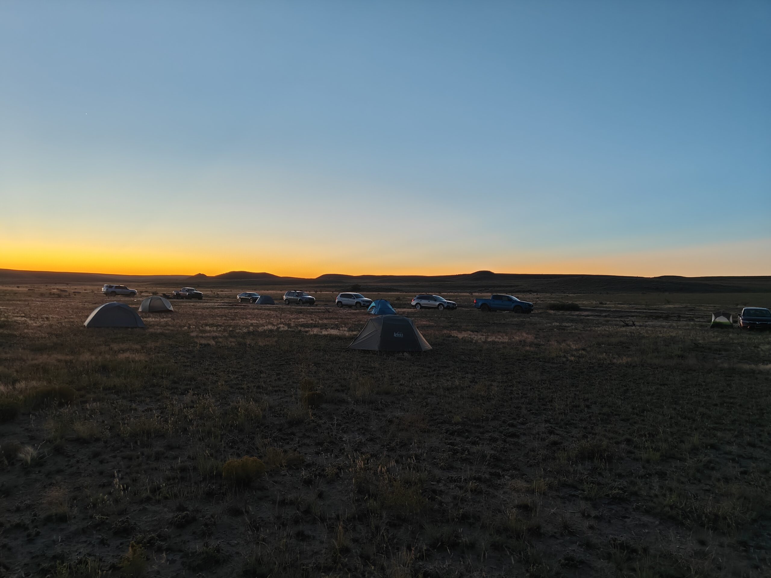
Friday 17th October
After a long summer break, it was great to be back for the next season of Project Yeso! Alex and Carrin arrived at around 6:30pm at the camp spot, and met up with a few of the NMT cavers who had arrived earlier. With the sunlight fading, we got to work on setting up tents, and preparing the evening meal: spaghetti and meatballs with a side of garlic bread.
This mostly(!) went to plan, and we were soon tucking in to a hearty meal.
We then got to work organising teams for the next day. With 16 people, we ended up with five teams: four working on survey, and one ridgewalking.
Saturday 18th October

Ridgewalking
Carrin (TL), Zach Adams, Ryan Marshall, Irene
This ridgewalk was a great kickoff to this season of Project Yeso. In true PY style, we found several interesting features that warrant further exploration.
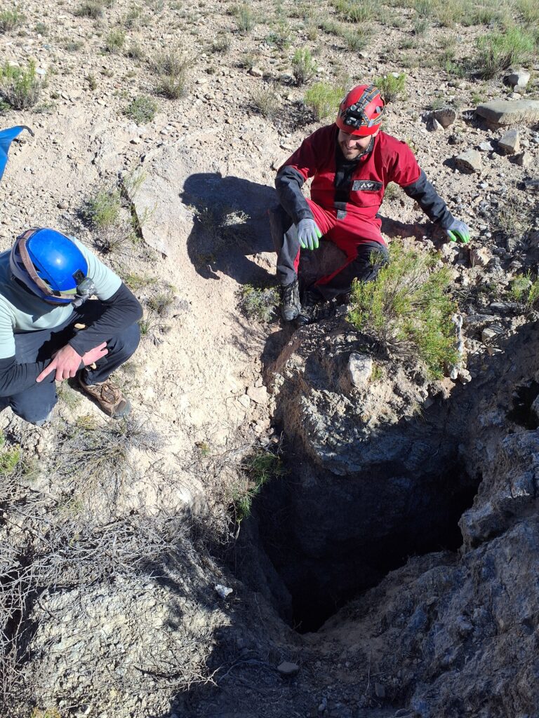
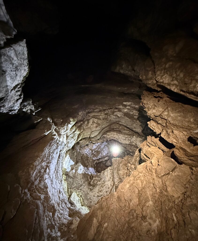
In total, we checked nine POIs in an area northeast of camp; six were existing POIs and three were features we found. By the end of the day, we had located a fissure system on a mesa top with multiple sinks and entrances, a promising dig and a cave entrance below the mesa (maybe part of the same fissure system), and a limestone cave with a chimney entrance.
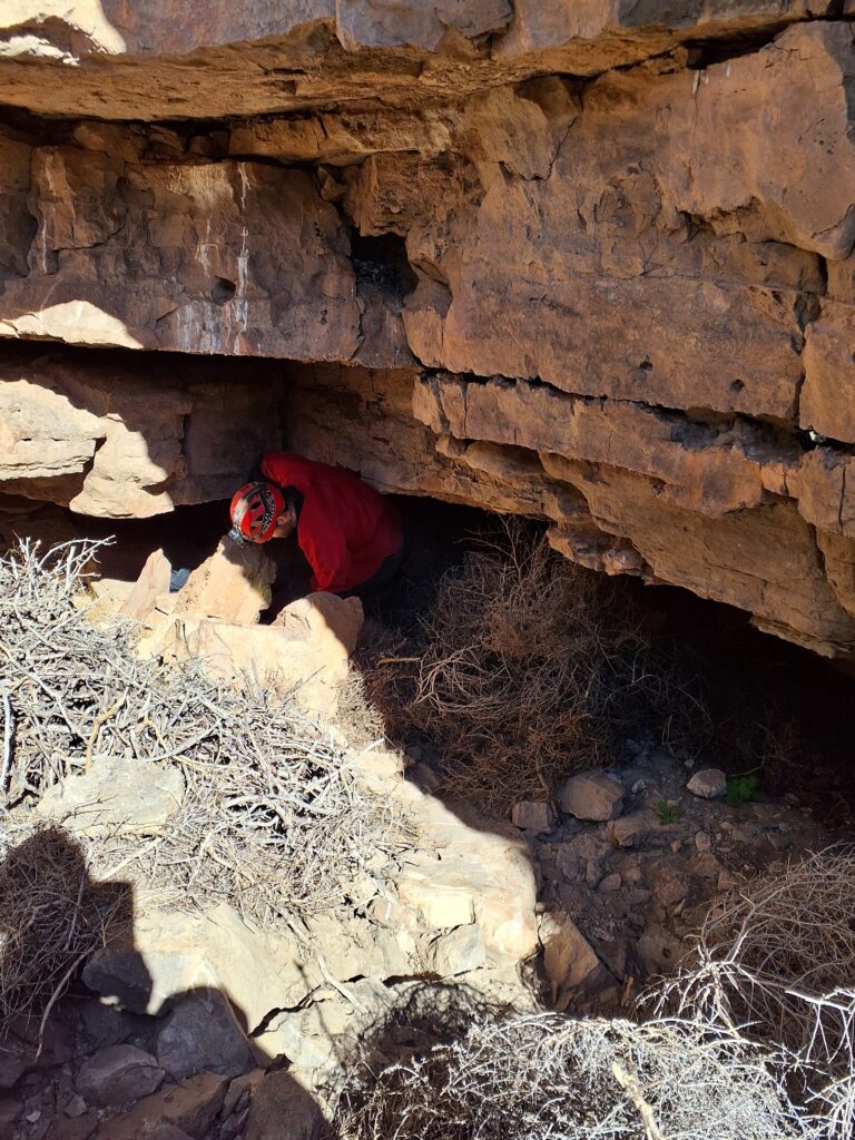
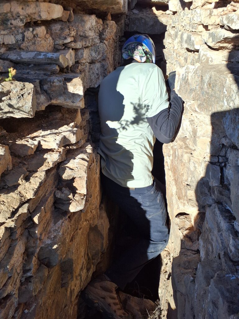
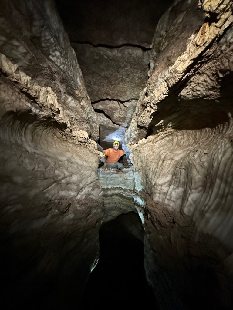
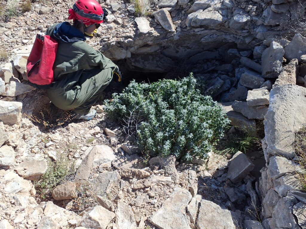
One of the best finds of the day, at the foot of the mesa, was a clean, smooth, vertical slot in solid gypsum that went at least 30 ft and is accessed by the humble hole shown below.
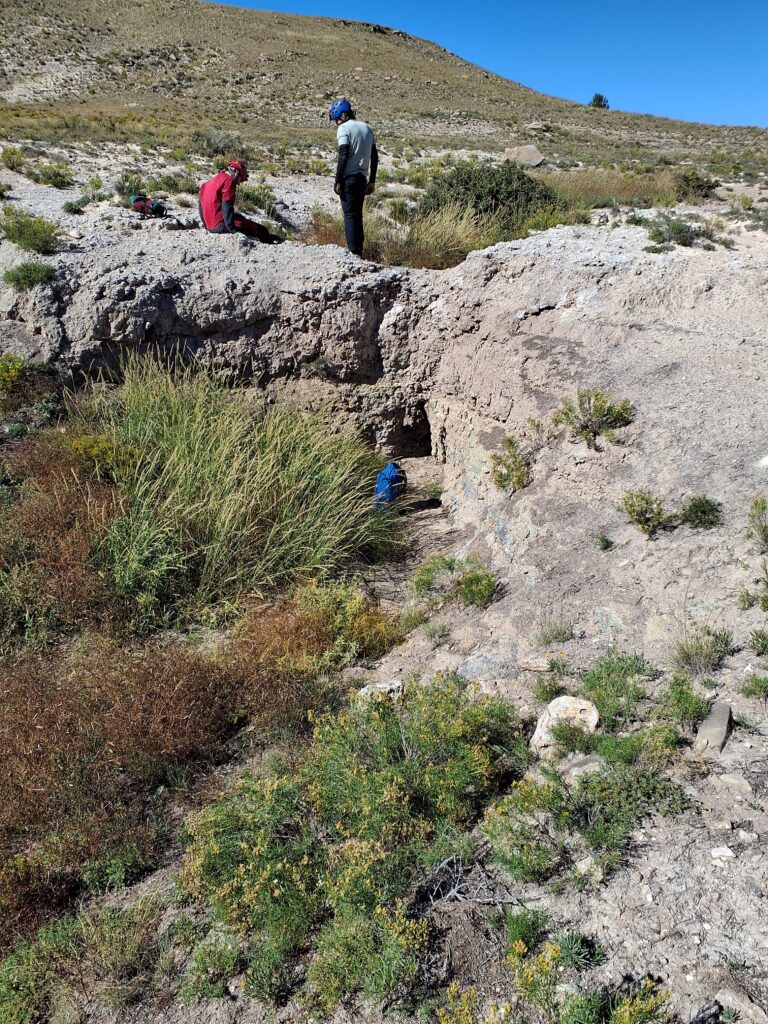
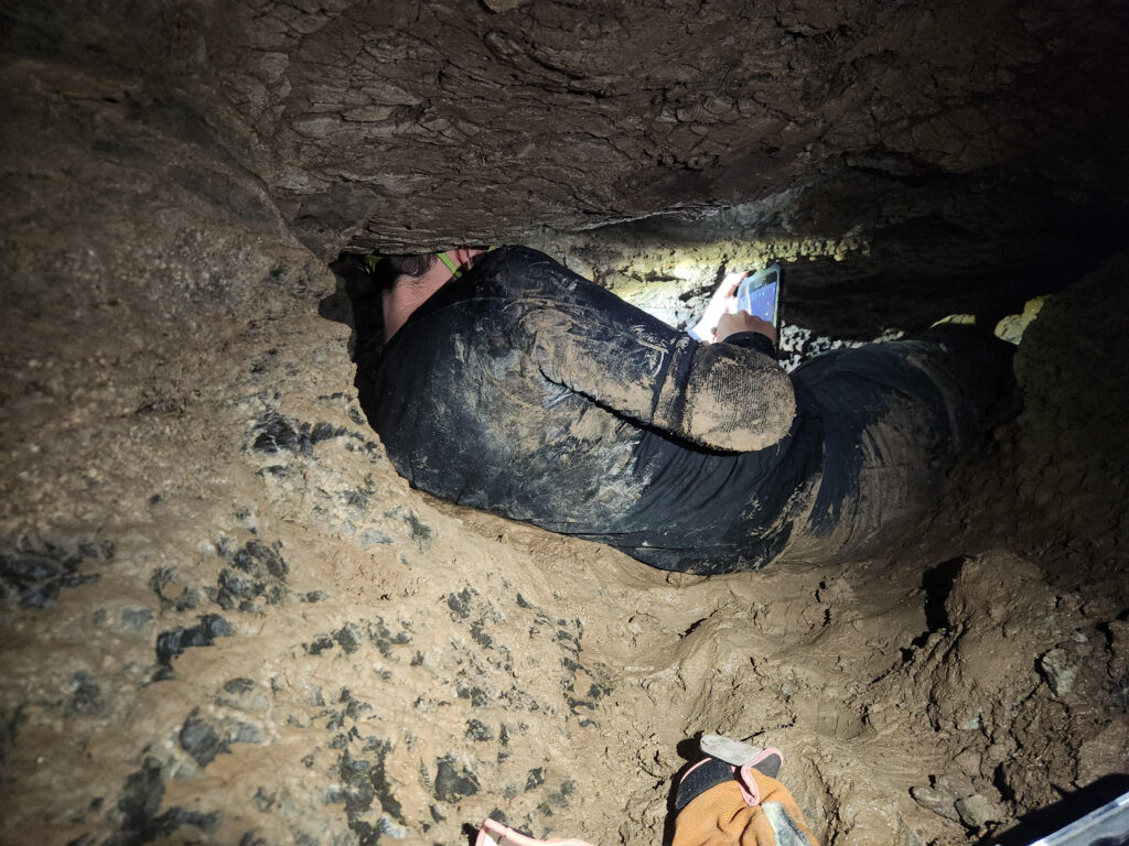
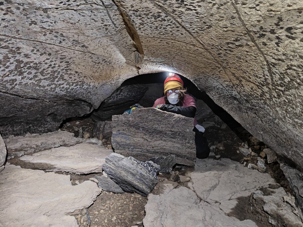
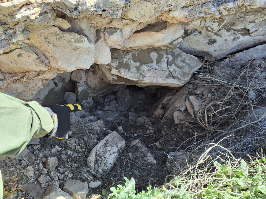
The feature in the pictures below is the dig at the base of the mesa. Behind the blue pack at left is an entrance into a horizontal tube that is plugged with tumbleweeds. Just above the tube is a body-sized hole that bypasses the vegetation choke… if you can fit!
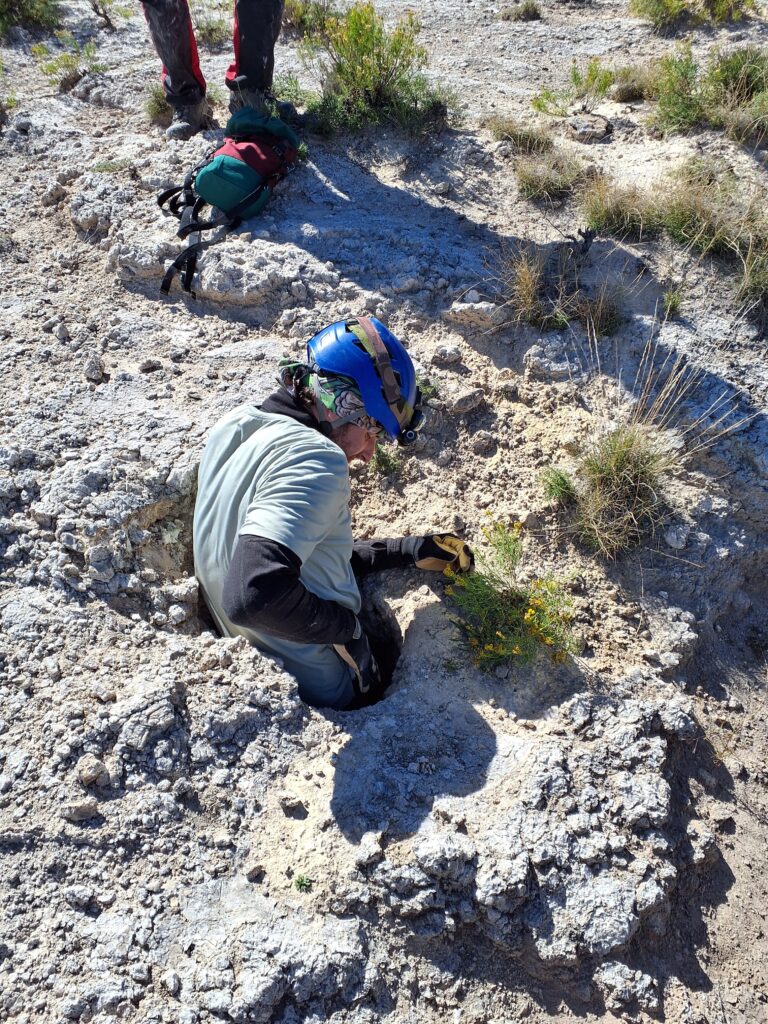
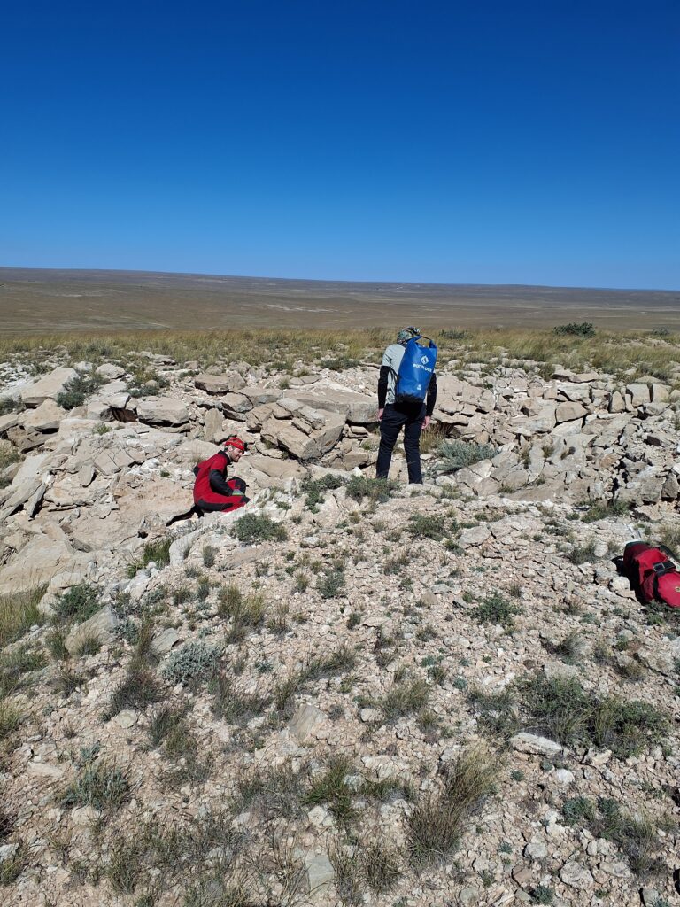
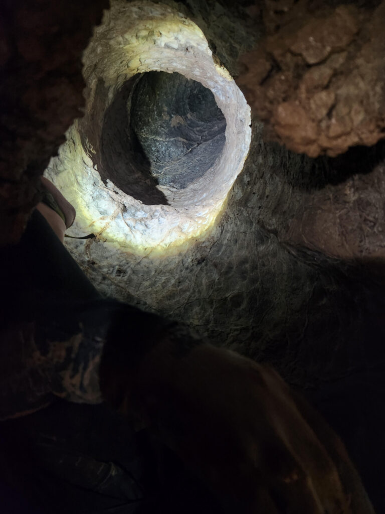
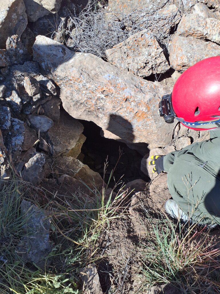
The day ended on a high note with the find below at the top of a large sink. Ryan and Zach chimneyed about 20 ft down into a void that went; they explored as long as they could before turning back for time.
3B-JD Cave survey
Erin Vair-Grilley (TL), Henry Little, Pierson Miller
Our team headed to 3BJD cave to continue survey. After arriving at the cave we set up a rope to rappel into the entrance off the I-bolt on the Subaru. The rigging secured, we headed in, Erin first. Once we were all in the cave we discussed whether or not a rope was really needed to enter/exit the cave. Our consensus was that it wasn’t needed, and the entrance could be free climbed. However, better to have a rope and not really need it, than not have a rope and need it.
Before starting survey, the Disto needed to be calibrated since it was brand new. Erin successfully calibrated the device and set off to start the survey. The cave was very muddy, due to the recent rains. We got to the survey face, but couldn’t locate the survey markers set last year. After lots of searching we finally found A21; we suspect the other markers were washed away during monsoon season. At A21 there is a crawlway straight ahead, a tube that goes up and above that crawlway (eventually connecting back into it), and a lower belly crawl passage. We chose to go straight ahead.
The passage was well formed. Erin started surveying while talking Henry through TopoDroid and how to use it and how to survey. Pierson powered ahead to get a lay of the passage and help set stations. The passage quickly turned to mud, muddy sticky mud and generally got smaller.
Erin passed off the survey to Henry for a few stations, but the environment didn’t really suit someone just learning to survey. At station A24 (I think) there was a really well formed chimney, which we explored briefly. The passage was clean and one could comfortably crawl. We didn’t find an end to this passage. We marked the survey station with a circle of string, as the mud prohibited a marker label, and no one had flagging tape… sigh.
Erin went back to surveying at A25 due to the mud and tight crawlway. The cave takes a 90ish degree turn here and then is a pretty straight passageway. The crawl opened up a little into a more streamway like passage. This portion of the cave smelled badly and had extra wet mud, black under the top layer that smelled very strongly. Eager to get out of the smell the three of us pushed through the survey hoping to get to the small room ahead (it didnt smell better, but all three of us could stand). We marked the final survey station of the day with a piece of flagging tape (found in the mud!) draped over the rock nub that was used as the station.
There was a lead at the bottom of the small room. Erin stuck her legs in, kicked around a bit, but her feet only had a few inches of up and down motion available to them. She then stuck her head in and determined that it would need to be dug open, but with the mud and time and smell opted to stop the survey there. The passage was about 8 inches in height. Hopefully the next trip will be dryer and easier to dig out.
The way out was uneventful, although Erin did take some time at A4 to switch the direction of the profile view lines so that they were correct. This messed up the survey around those points that had previously been drawn. There was not enough time to try to resketch the profile that was now messed up (but going in the correct direction).
We exited safely, de-rigged the rope and went back to camp.
Toad Hop Cave survey
Andrew Orr (TL), Cameron Sanchez, Sarah Haft
Saturday brought another bluebird day in central New Mexico. We made the mile-long walk out to the cave, expecting a long day of mapping — or so we thought. Once we arrived, we geared up and had a quick chat about the day’s plan.
Our goal was to reach the water level and see how high it was after the summer rainstorms. My thinking was that if we could assess the current water level, we might get a sense of what was happening beyond the sump section — whether the cave was draining quickly or backing up. If the water was rising and holding, that might mean there’s less passage beyond the sump than we hoped. But if it was draining well, then maybe the cave continues on. There’s no doubt this system takes in a lot of water, so I was still optimistic that it might extend significantly farther.
We headed into the cave and reached the familiar vertical downclimb. On our last trip, we had used both a handline and a cable ladder here, but this time I only brought a handline. We rigged it and I asked Cameron and Sarah to try the descent without using it to see whether it was actually necessary. If they could manage the climb safely without it, we could save some setup time on future trips. As it turned out, all of us were able to climb down and back up without much trouble, so while we’ll still bring a line as a precaution, it won’t need to be rigged regularly.
When we made it down to the water, I was pleasantly surprised — the level was only about an inch higher than before. That’s a great sign. It means the cave continues on! Once we get the survey extended to this point, we’ll have to push the passage and see where it leads.
After the climb back out, we took an early lunch and got ready to start surveying. Since I’m still relatively new to cave surveying, we picked up where we had left off and spent a bit of time catching up on sketching before moving on to new centerline shots. Unfortunately, the day quickly turned into a comedy of errors. Topodroid had a bug and wiped out all our sketch work, and then the geometry of the new centerline shots I took started making no sense. When we reached the last survey station and I took a centerline shot for the next leg, everything felt like it had gone to hell — the Disto readings were completely wrong. That’s when it hit me: the calibration was off. All our earlier splays for sketching were likely wrong too.
Rather than try to re-calibrate underground (which I wasn’t entirely confident doing yet), we decided to shift gears and ridgewalk the rest of the BLM parcel we were working in. Unfortunately, that didn’t turn up any new cave entrances, so we headed back to camp.
Despite the setbacks, it was still a solid day underground — a reminder that troubleshooting and problem-solving are as much a part of caving as the survey work itself.
Tummy Troubles survey
Alex Seaton (TL), Ethan Haft, Piper Weekly
After the extended morning faff we finally got on our way to Tummy Troubles. It was a beautiful day with not a single cloud in the sky!
We got geared up and made our way to the cave entrance. This was Ethan and Piper’s first time visiting Tummy Troubles, and I was excited to show them the cave.
Unfortunately as we arrived at the cave entrance it occurred to me that I had forgotten to remind the survey teams to bring sharpies for marking survey stations. Plus, I hadn’t brought any myself. Oops! Our team was planning to sketch passage that had already been line-surveyed, so I figured we’d be okay.
We made our way into the cave and headed to station A16 where Austin had stopped on our last survey trip. Ethan and Piper were interested in learning to sketch, but opted for a gradual introduction rather than being thrown in at the deep end on their first trip. So I got started and narrated the process to them as I worked.
The first task was to calibrate the disto, since we were using a freshly built one. This was slow and tedious as usual, but I explained the process to the others and collected all of the readings without too much trouble. We then finally got started with the sketch.
From A16 the nature of the cave changes and things get a bit more serious. There’s the tight tube from A16-A18, followed by the start of the rough limestone cobble crawl. We sketched through to A18, and then started work on the cobble crawl. Which is where the problems started…
The shot from A18 to A19 is fairly long, and on moving to A19 I got to work taking splay shots so I could draw out the walls. But once they were loaded on the tablet I realised something was wrong. The splays weren’t lining up with the ones from A18. On the tablet, the wall connecting A18 looked like it jumped about a meter sideways between A18 and A19. Not good!
This suggested to me that there was something up with the readings from the disto. Maybe my calibration wasn’t as good as I thought? I also realised, looking at the data in the tablet, that the line-survey shots we were working off had been flagged in Topodroid. So perhaps the original line survey was the problem. Either way, we needed to figure out what was going on so we tried a few troubleshooting steps.
Our first check was to try shooting from A18-A19 and see if the reading agreed with the original line survey. It didn’t! Again, with an error of around 1m. We tried again with A19-A20, and found a similar issue. But what if the current disto was the issue? We tried doing a backsight shot (A20-A19). The forwards and backwards shots didn’t line up wonderfully, but the error was substantially smaller than 1m, so I figured the calibration was acceptable.
With a bit more confidence in the current disto calibration, we decided to switch gears and re-shoot the line survey from A18 onwards. Unfortunately, by this point we were running short on time, so after taking a few shots we decided to stop for the day and make our way back to camp.
Wedgie Cave survey
Eoghan (TL), Cody Sinclair, Tom Weber
Our objective for the day was to sketch the profile of the cave from the entrance. That included untangling some line survey data along the way, where Topodroid had extended legs in the wrong direction. We had some difficulty in finding a number of stations (A1, A3, and A10 stick in my mind). Despite some difficulty in finding a few stations and having to reverse engineer a few shots, we made pretty good progress.
Interestingly, we didn’t need the normal KN95 masks that we bring to Wedgie Cave, the dust was out of fashion today and mud was in. Eoghan was, of course, dressed for such an occasion in his trusty AV oversuit and didn’t think it was bad. We profiled all the way up to A29, where there is (usually) a dusty climb down to a brief crawl through loose soil. Today that was a slippy muddy climb down to a crawl with mud on the floor and ceiling, and tiny mushroom like things growing out of the mud. The team wasn’t feeling pushing things further so that is where we called it a day.
Sunday 19th October
Ridgewalking (team 1)
Carrin (TL), Irene, Tom Weber, Piper Weekly
This ridgewalk was unusual for Project Yeso, in that we found virtually nothing! The team set out for a cluster of POIs, augmented by lidar points from Tom, just west of the other ridgewalking team; they found quite a bit, but our points were shallow and undeveloped, so the geology must change between the two areas.
In all, we confirmed five POIs as not caves and one as a low-potential dig.
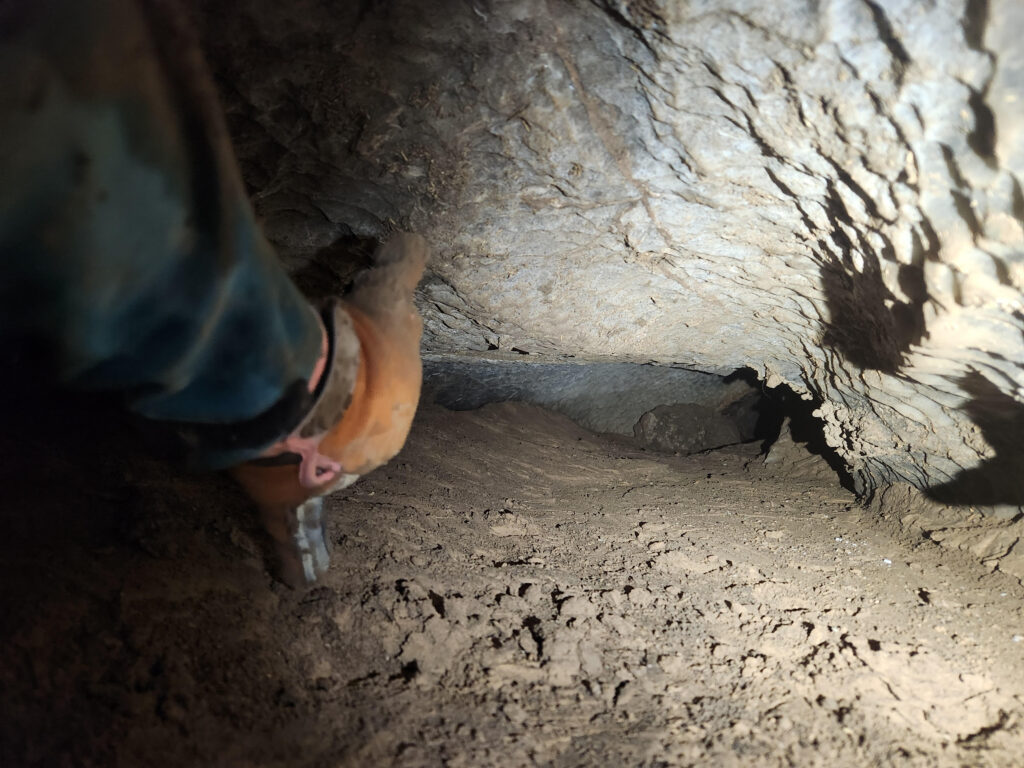
Piper squeezed into this little nugget (below), only to run into a 15-foot drop about a body length in. We classified the feature as a dig that will need a handline and some rock-moving to fully explore, but given the lack of development in the surrounding terrain, a return trip here is low on the Project Yeso priorities.
After completing this area, the team crossed the road and fanned out over a tall mesa. Hopes were high, as a twin mesa to the east hosts a significant fissure system (see the Saturday ridgewalk above), but alas, this mesa had nary a hole.
As always, it was still a productive day. Several POIs were investigated and documented, Tom got to see what some of his lidar points looked like on the landscape, Irene had a second day out on this rugged new terrain, and Piper continued honing QField skills.
Ridgewalking (team 2)
Eoghan (TL), Ryan Marshall, Pierson Miller
We worked on ridgewalking in an area to the North-East of camp and found a pair of interesting holes that require further visitation. And a few small holes that really aren’t worth the trip back. We have more points of interest in that area for investigation. Interestingly the other group who were only a few hundred meters west of us didn’t find a sausage.
🎃 Toad Hop Cave: A Haunted Survey Sunday 🎃
Andrew Orr (TL), Zach Adams, Henry Little
October in New Mexico can be scary for all sorts of reasons — but this time, the ghosts were in the gadgets.
Sunday dawned under yet another bluebird sky. I know, I say that all the time in these reports, but when you’re in central New Mexico — where the weather can change from sun to sideways hail in an hour — it feels almost supernatural when the skies behave. The perfect day for some Halloween-weekend cave work… or so we thought.
We set off on the familiar mile-long walk to the cave, spirits high and survey gear in hand. I was determined to make up for Saturday’s technological horror show and turn Sunday into a productive day underground. Oh, foolish mortal optimism. Once we reached the entrance, we suited up and slipped into the cave’s cool breath. Our plan was simple: check a previously surveyed station, take a backsight, and confirm that the Disto — our laser distance meter — was behaving. But as soon as we fired it up, the red beam flickered like the eye of some ancient spirit and spat out numbers that made no sense. It was cursed. Again.
Luckily, Erin had given me a crash course in Disto exorcisms the night before, so I began the calibration ritual in the big room — plenty of space to summon the accuracy demons. I performed the sacred sequence of beeps and button presses… and was rewarded with pure digital gibberish. No fun. We did this twice, hoping the second incantation might please the cave gods. It did not.
Frustration mounting, we decided to escape our technological torment and explore for a bit. Henry, Zach, and I wandered through the main passage for about an hour, letting the silence and shadows calm our frayed nerves. It was quiet down there — too quiet — broken only by our footsteps and exhalations of appreciation for the cave.
Eventually, we returned to the big room, ready for one last shot at redemption. I pulled out the backup Disto — the “good twin,” or so I hoped — and began another calibration. This time, to everyone’s surprise, it worked. The readings were perfect. Whatever poltergeist haunted the first Disto had apparently decided we’d suffered enough.
We returned to the main passage, deleted all the corrupted data from the day before (a digital exorcism of its own), and started fresh from our last reliable survey point from May. Finally, the data made sense — distances lined up, bearings behaved, and we could almost hear the cave sigh with relief: “YOU’VE DONE IT!”
After an hour of solid progress, we packed up and made our way back to the surface, blinking into the bright daylight like we’d just emerged from another world. We didn’t bring home a ton of new survey data, but we did collect plenty of lessons — and maybe a ghost or two still lingering in that first Disto.
As we hiked back to camp under the dropping sun, I couldn’t help but think: next time we’ll get you, cave!
Tummy Troubles survey
Alex Seaton (TL), Sarah Haft, Cody Sinclair
The Tummy Troubles team for Sunday was myself, Sarah and Cody, who were both new to Tummy Troubles. After packing up camp we drove out to the cave, again enjoying the perfect weather.
After the various technical issues the previous day, I was keen to try and get the disto problems resolved. We had two distos with us for this trip, including the one I had calibrated the previous day.
We traveled a short distance in to the cave and got to work on calibration. This time I picked a more spacious area to work in, and spent a lot more effort trying to get accurate readings. I soon realised that the calibration I’d done the previous day wasn’t great, so made a fresh attempt and was able to do a much better job. With the new calibration, front and backsight readings agreed much more closely.
Given that disto calibration isn’t exactly the most exciting activity, I suggested Sarah and Cody go explore a little further into the cave while I continued working. We set a meet-up time and they headed off while I started work on the second disto.
After a while they returned from their adventures and waited patiently while I finished getting the second disto calibrated. Once that was completed, we did some test shots and made sure measurements from both the distos agreed, and that backsights matched (they did). Finally!
We still had some time left before we needed to leave, so we decided to work on making sure the line survey was accurate. We worked from station A6 through to A20. Six of the original survey legs turned out to have fairly significant errors, so we re-shot those.
By that point we were running short on time, so we decided to call it a day and head out to meet the others. Sarah had dropped a head lamp on the walk out to the cave, so we made our way slowly back to the car, but sadly weren’t able to find it. On the plus side, we did spot a tarantula!
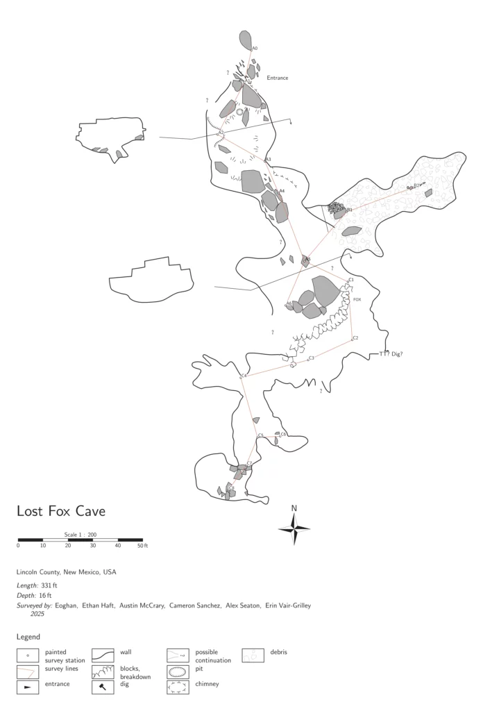
Lost Fox Cave survey
Erin Vair-Grilley (TL), Ethan Haft, Cameron Sanchez
We left camp and walked to the cave. The tree that is at the entrance was large and in the way so we just pushed into the cave through the branches. Our objective was to continue resurvey of the cave starting at A5. Erin started sketching while Cameron and Ethan set about familiarizing themselves with the cave and where there might be leads. Erin sketched from A5 into a second chamber, which was designated B survey. The room with the lost fox is on the B survey. Any time a new station was needed, one of the other cavers came over and help her set it.
After the completion of the B survey, Cameron took over sketching and began the C survey. Erin walked him through how to use TopoDroid. Leads were checked as we went, many just looped back into the chamber or into another one. Cameron worked away on the C survey, Erin helping to set the stations. Meanwhile Ethan educated us on the cave structure from a geologic perspective. It’s a mix of limestone and frail gypsum that is eroding causing the limestone blocks to collapse. We noted signatures dated 1927 along the cave wall in the C survey. Erin helped with the survey throughout the C survey, but Cameron was doing a great job having not sketched for some time.
We exited the cave for lunch after finishing almost all of the C survey. The cave was too dusty and smelled of pee, so no one wanted to eat in the cave.
After some snacks we went for a small wander to look at the other depressions nearby, knowing they had been looked at before, but enjoying the sunny warm day. We found a tortoise near the cave entrance. It was about 3 inches long, had a pretty shell and looked healthy, but was not impressed with us being near. It was super cool to see! Once returning to the cave entrance we settled on heading back to camp since there wasn’t enough time to enter the cave again and make much progress.
We arrived back safely at camp and waited for the other teams to arrive.