Participants
- Ethan Alvarez
- Evan Bowen
- Ethan Haft
- Sarah Haft
- Pierson Miller
- Sharon Minnix
- Kayla Navarro
- Carrin
- Fernando Rodriguez
- Cameron Sanchez
- Alex Seaton
Friday 9th January
With a smaller group than usual, we were going to need some new team leaders and sketchers on this trip. Cameron and Evan both offered to help with this, and were subjected to an evening of Alex’s sketch training earlier in the week.
We’d also had a minor emergency as one of the cavers who had originally offered to help transport communal gear to the field house came down sick and so wasn’t able to make it. Fortunately, Kayla stepped in at short notice and offered to bring some of the gear in her vehicle. Phew!
Once the majority of the group had arrived on Friday evening, we split into two groups. One group worked on preparing dinner (Cameron’s gnocchi and italian sausage recipe, plus garlic bread), while Alex, Cameron, Evan, Ethan, and Sarah worked on some last-minute sketch training. By the time dinner was ready, we had four good sketches of one of the side rooms in the field house.
After dinner, we organised teams for the next day. With 11 people, we had enough people for four teams, with three working on survey and one team ridgewalking.
Saturday 10th January
3B-JD Cave survey
Cameron Sanchez (TL), Sharon Minnix, Fernando Rodriguez
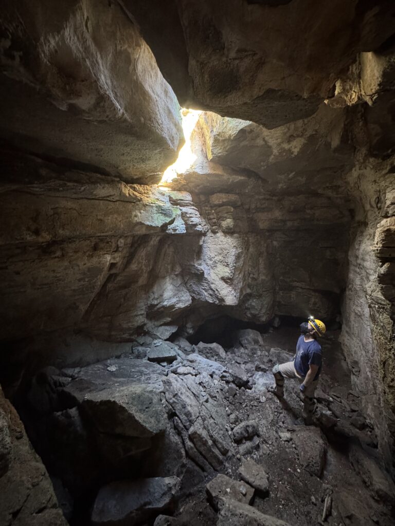
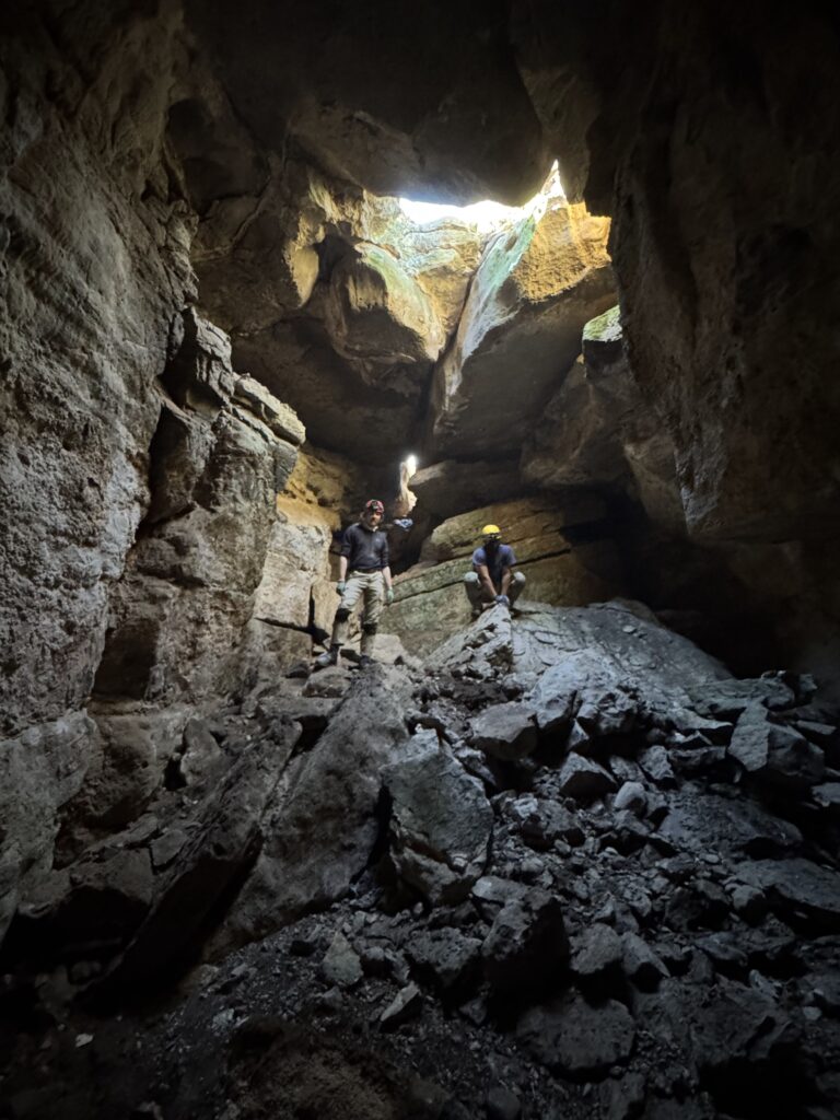
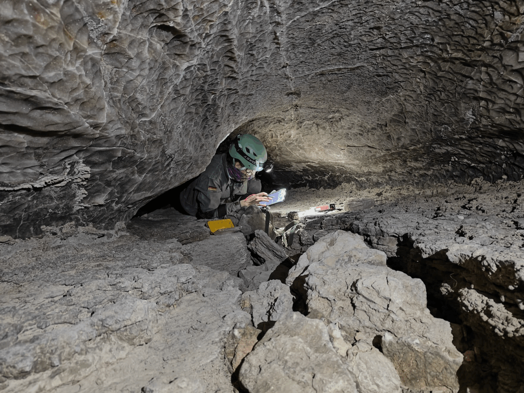
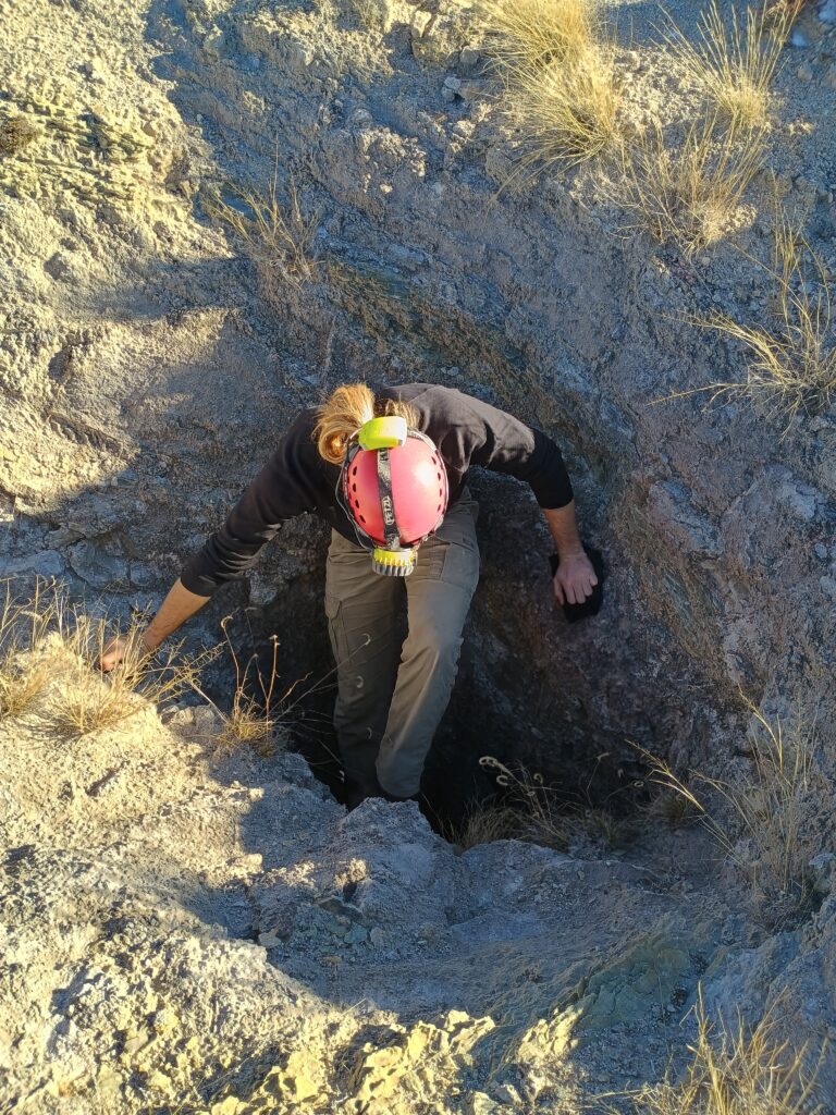
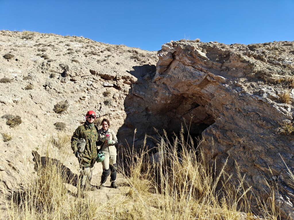
Our team headed into 3BJD cave to continue work on the existing survey portions. Our plan was to continue from survey stations A28, B2, and start a new survey of the unmapped lower passageway from A20, if there was time.
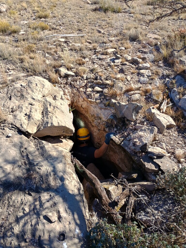
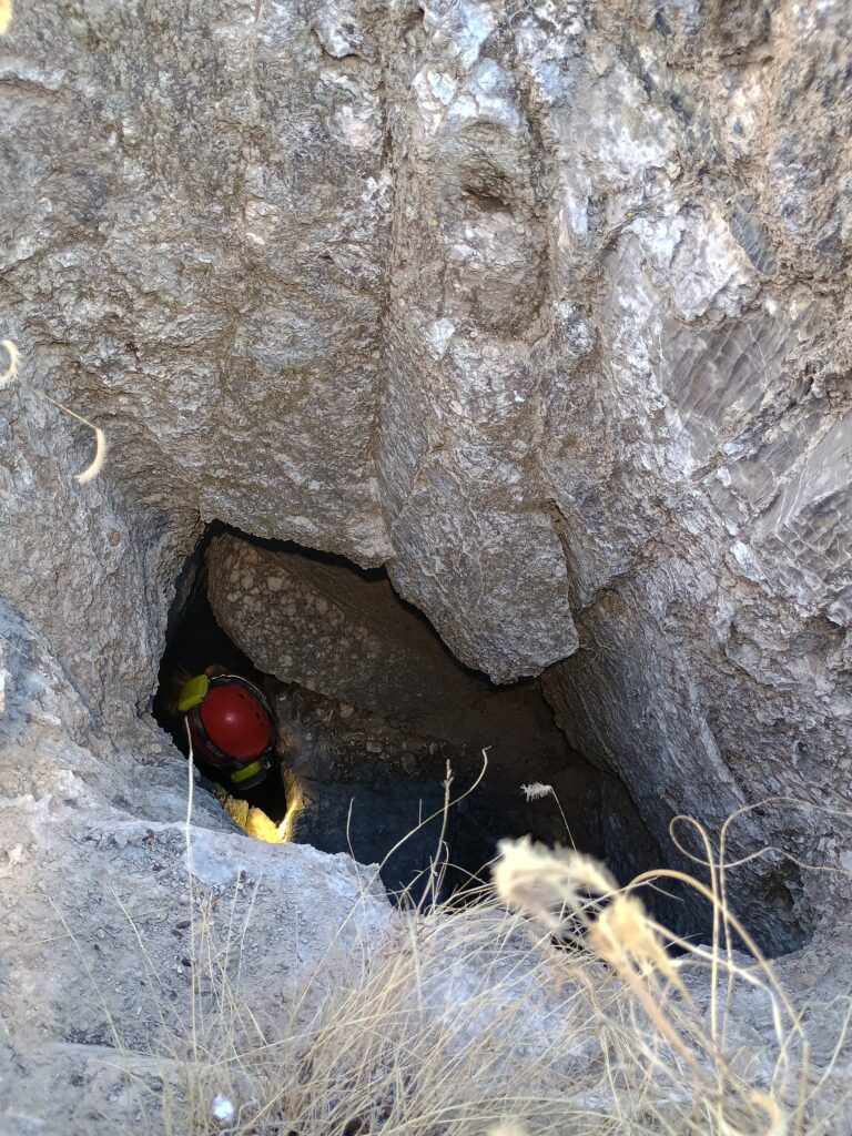
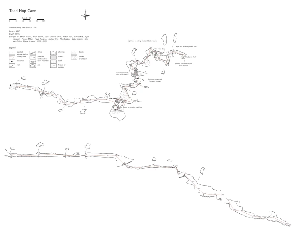
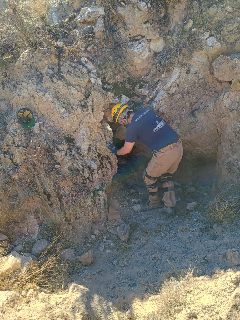
Approaching the cave, Cameron had noticed that there was a significant amount of boulders that had washed into the entrance when compared to prior visits. The extra boulders had made traversing into the entrance of the cave without vertical gear possible. Cameron proceeded to lead the way and climb down into the cave entrance first,followed by Sharon and then Fernando. The entrance was an easy downclimb with a few loose rocks to be mindful of.
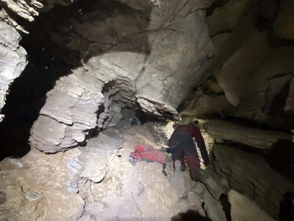
The team entered the cave at 10:20am and made their way to the 3-way junction area. The junction was known to have 3 separate routes to travel through and survey, the lower route being the unsurveyed one. On the way to A20 the team had noticed a decent amount of sediment and debris buildup all around in the passages. Curious about the condition of the cave allowing for viable traverse, Cameron decided to have the team leave their bags at the junction and scout ahead to the upper two passages to determine which passage to start on first.
Cameron led the way to survey station B2 with Sharon and Fernando following. Survey station B2 was located on the top level of the cave near the upper exit of a chimney. Cameron climbed up the chimney with Sharon following behind. Once at the top of the chimney Cameron continued down the passage while Sharon waited at the chimney exit. Cameron persisted through slick rock that was heavily laden with mud and water. As the passage continued, traversing became more and more difficult. The mud became very deep and did not allow for good traction. As Cameron attempted to reverse out of the passage it quickly became apparent that the conditions of the passage were dangerous for the team. With great effort, Cameron reversed out of the mud completely and returned back to the exit of the chimney to discuss the conditions of the passage with Sharon. Sharon and Cameron both then scaled down the chimney to meet back with Fernando in the middle passage to brief him on the conditions of the upper level.
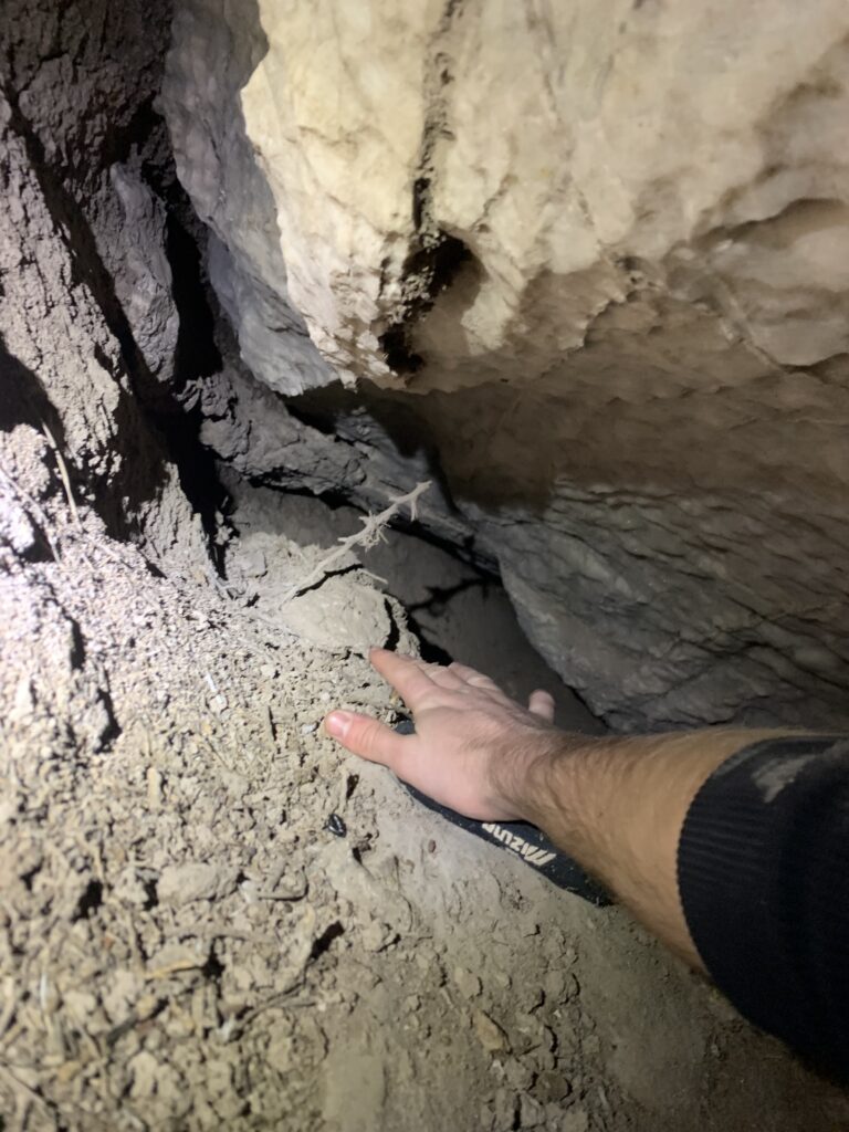
Cameron headed through the middle section to see how far it was possible to travel. The deposited mud from the rainy season had built up significantly and had caked the floors and parts of the walls. Moving through the middle section from a tight crawl to a standing section proved to be too tight for the team to pass through and continue. The team then headed back to the junction area to check out the condition of the lower passage. When peeking into the lower section, Cameron noticed a significant buildup of large rocks and boulders that had mostly obscured the path, and had decided not to push any further.
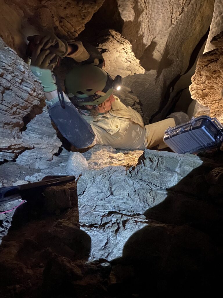
With the conditions of the cave impeding travel, Cameron decided to review the existing survey data and hopefully find something to survey near or before station A20. When looking around, Sharon and Fernando discovered a small side passage that was partially obscured by a boulder across from station A20. Cameron reviewed the data and had found this section had not been surveyed. Cameron and Sharon headed into the small passage and created a new station named A21A. The first few shots of the passage went well without issue, but as Cameron and Sharon had reached the newly created station A21C the utilized Disto was having reading issues. There were many attempts to create new stations but the Disto seemed to only provide splay shots. After many resets and re-shoots, Cameron and Sharon were able to complete a line survey of around 7 stations before the passageway became too tight to continue. After the line survey had concluded, Cameron, Sharon, and Fernando exited the cave at 2:30pm and headed back to camp.
Toad Hop Cave survey
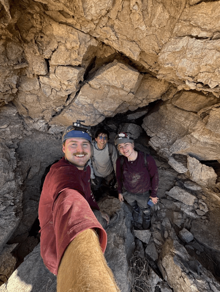
Evan Bowen (TL), Kayla Navarro, Ethan Alvarez
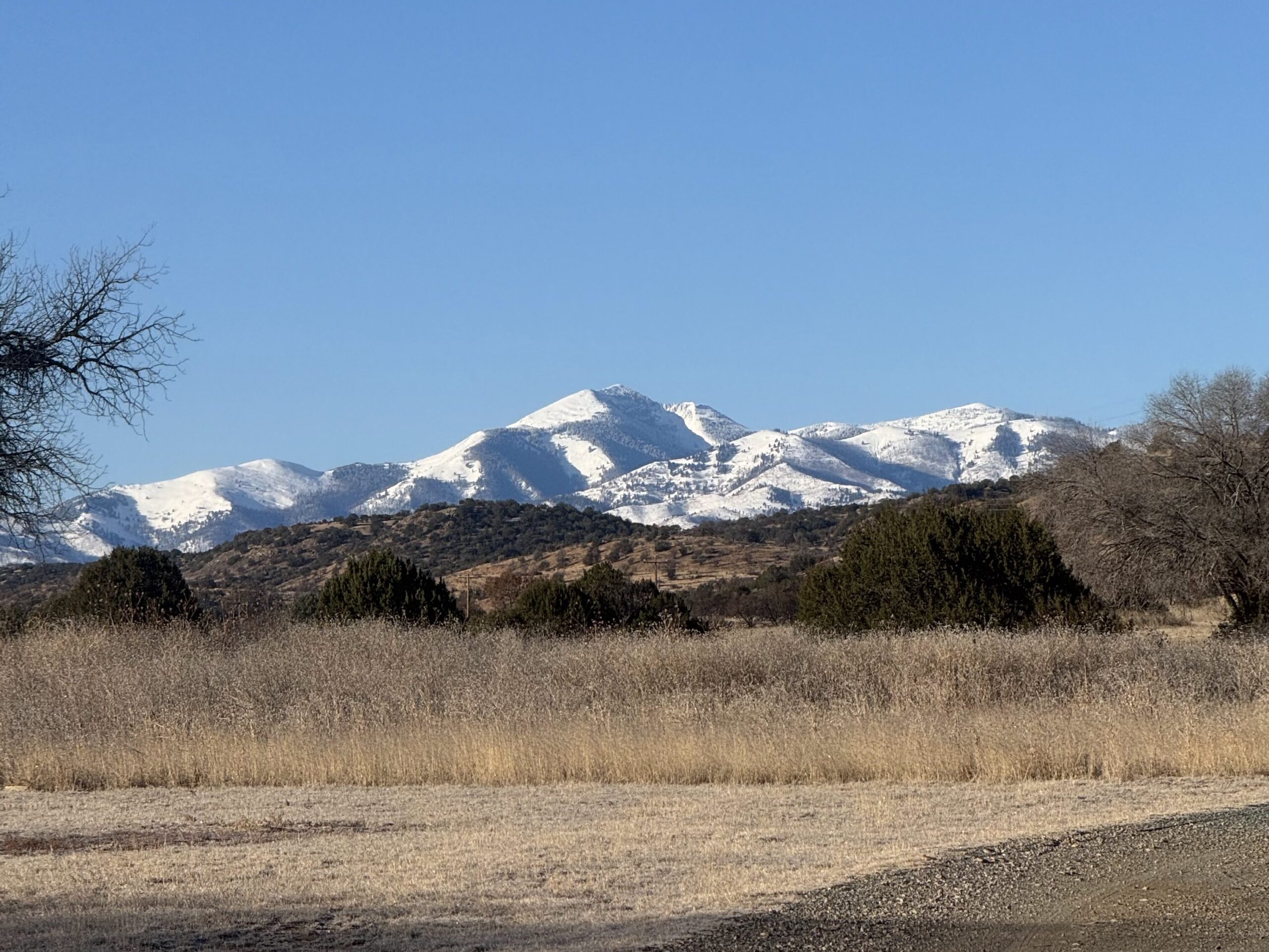
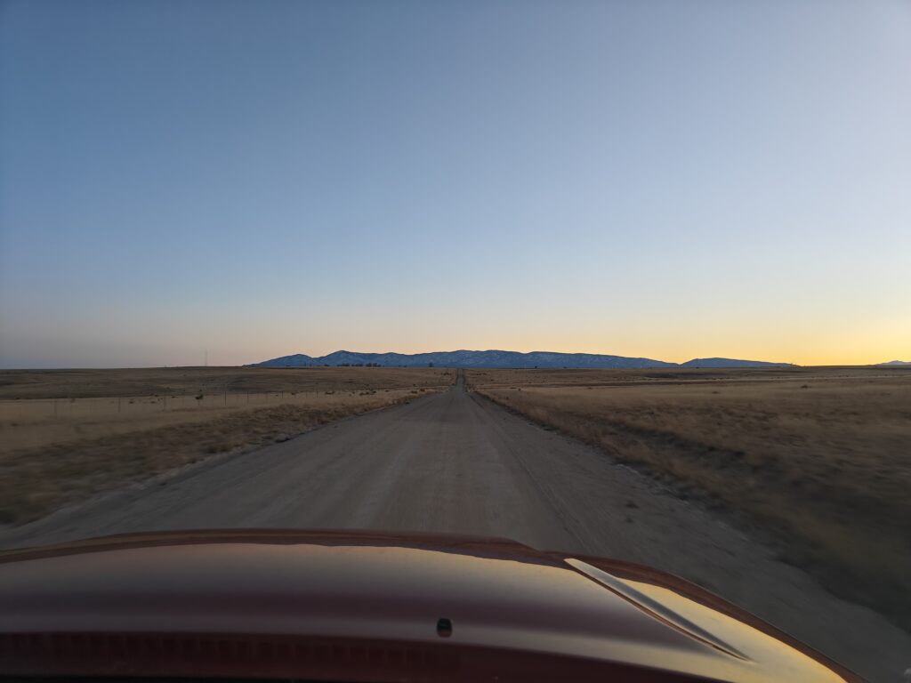
Saturday morning was brisk and chilly, but the weather was clear and the views of snow-topped mountains breathtaking. Our survey team was the first to leave the field house on our long drive to Toad Hop Cave. Once we arrived at the parking area, we suited up in the cold before walking the 1 km hike to the cave entrance.
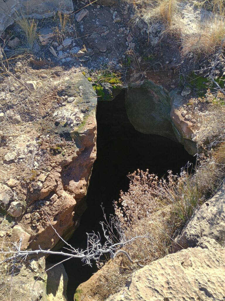
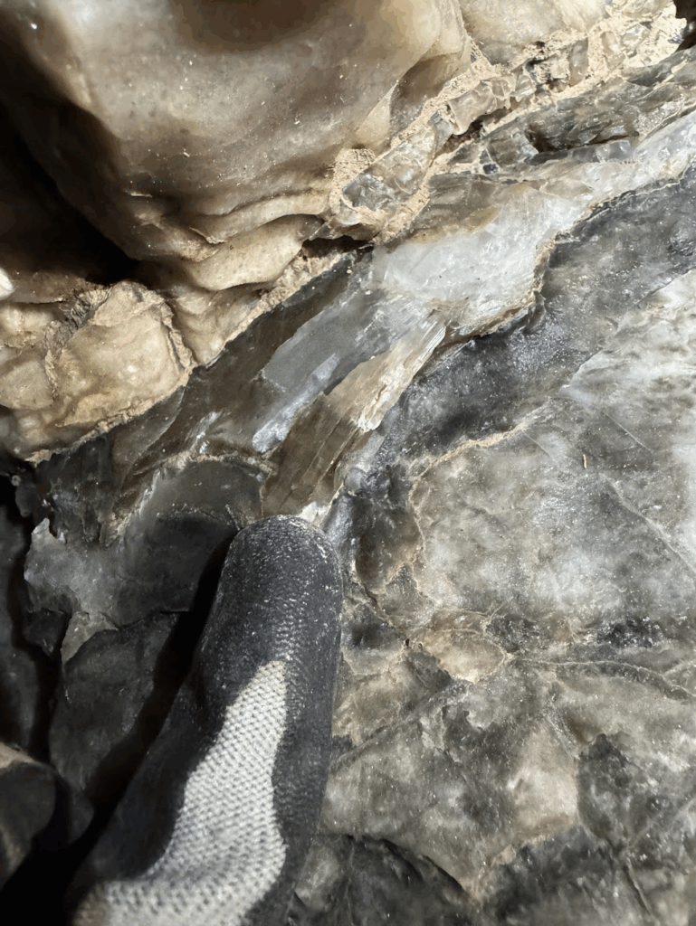
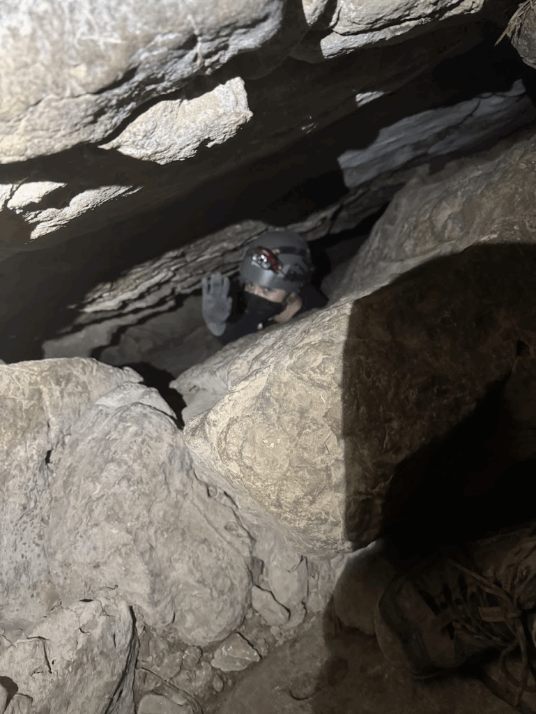
We entered the cave sometime around 10:30 AM with the objective of surveying the main passage to the partial water sump. We decided to first make our way down to the partial water sump to see if the water level had gone up or down since the last visit to the cave. Evan was able to attach a GoPro to his helmet and capture the whole journey down into the cave. Toad Hop Cave is a very dynamic gypsum and limestone cave, with multiple squeezes and crawls, vertical and horizontal. Upper passages consist mostly of dry and dusty crawls with one exception being the big room. The lower levels past the “butt crack” open up into an entirely different cave, with wet and steep walking stream passages that wind through gypsum and selenite veins. The “butt crack” is a massive fault or fracture feature at A15/A16 that is downclimbable, but separates the upper and lower passages. After getting to the partial sump, Evan was able to see that the water level was a few inches higher than his last visit to the cave in May. Fortunately, the water did not go all the way up to the ceiling (maybe 10-12 inch air) and the passage beyond was clearly visible. Our group then decided to name the sump feature the “Septic Tank” as it had not yet been named.
After some more scouting, we headed back up to the “Toilet Bowl” to continue surveying from survey maker A23. The Toilet Bowl is a steep and wet vertical climb up an oddly shaped bowl like pit in the passage that can be difficult to climb. Since A23 was directly above the Toilet Bowl, Evan decided it would be best if only he climbed up to take the first survey shots while the rest of the team stayed lower in the bowl to create stations. He noticed that our last survey shot was at a depth of 67 ft, so the possibility of getting below 100 ft quickly became a team goal. A brief panic with the Disto not functioning properly made him realize that the GoPro mounted on his helmet was interfering with our shots. Luckily he caught this at our first station and a quick check with temporary stations ensured that everything was calibrated correctly. At first our pace was slow, but eventually we picked up the pace and became as efficient as a well lubricated machine. Evan was able to show Kayla and Ethan some of the sketching features, while both of them traded point and instrument duties half way through surveying. After a final push, we surveyed all the way down to the Septic Tank to survey A32. To everyone’s delight, we had surveyed to a depth of 102 ft below the entrance! Now that the survey has gotten to the Septic Tank, future trips will be able to survey beyond this partial sump feature. The water in the passage goes for around 8-9 ft through slick mud, so a wetsuit or change of clothes will be needed. We have high hopes for this lead, as it appears to contain walking passage past the water.
Once we finished surveying, we packed up our items and headed back to the chamber below the “butt crack” at survey marker A17/A16. We investigated multiple side leads in the chamber, many of which had not been previously noted on the survey. Some of these leads were accessed by climbing through breakdown in the passage. Future teams should survey these leads, as some smaller passages go off from the surveyed area for ~20-30 ft (hole in breakdown next to A17, left side of A16 facing A17). A tight chimney climb up the “butt crack” off the side of A16 (right side of A16 facing A17) goes back up into upper passages, and goes around a blockage near A15 (right side of A15 facing A16) and needs to be investigated and possibly surveyed. After our investigation of leads, we finally exited the cave at ~2:30 PM for some well deserved lunch.
After heading back to the car, we decided to check out Gourd Cave on the other side of the hill to see if there was any possible connection (given a low possibility). The cave is small and the main passage continues through small crawls but narrows into tight pinches and possibly continues but is difficult to tell for sure. After our adventure in Gourd Cave, we headed back to our cars and parted ways. Overall, it was a great trip and an excellent learning experience for everyone involved!
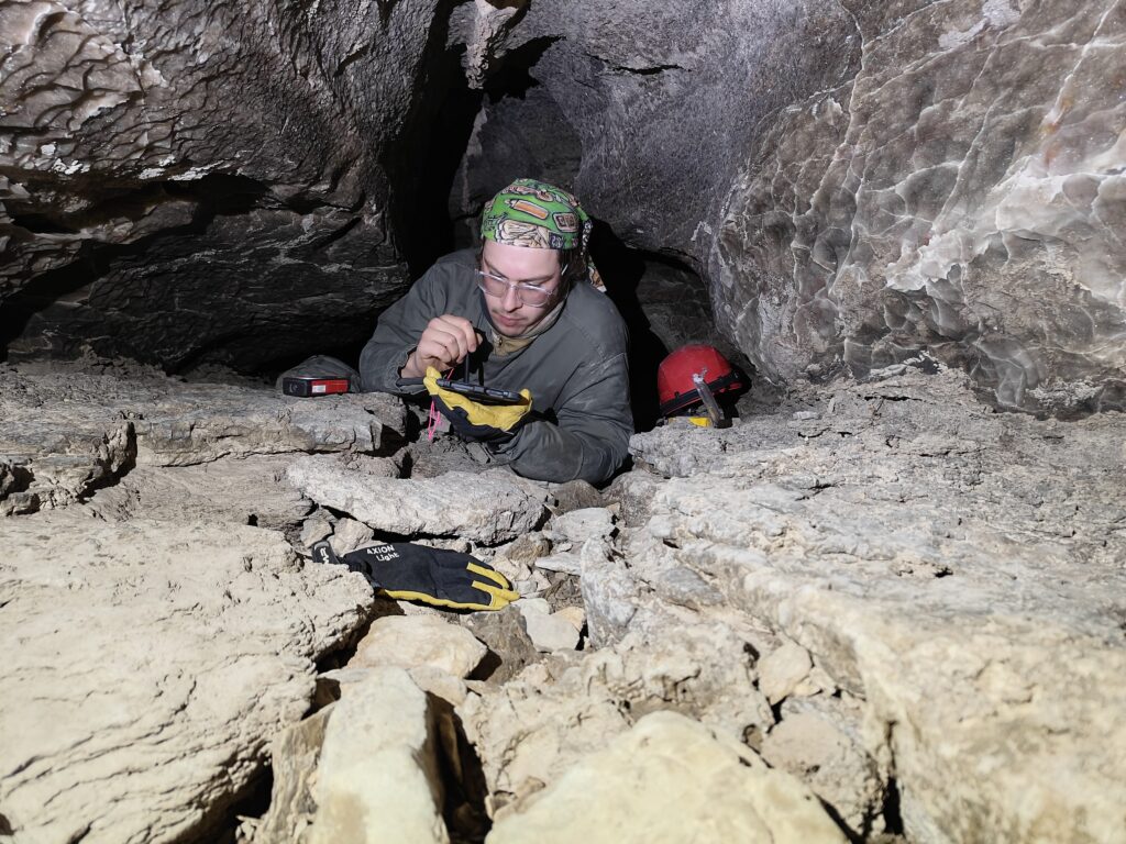
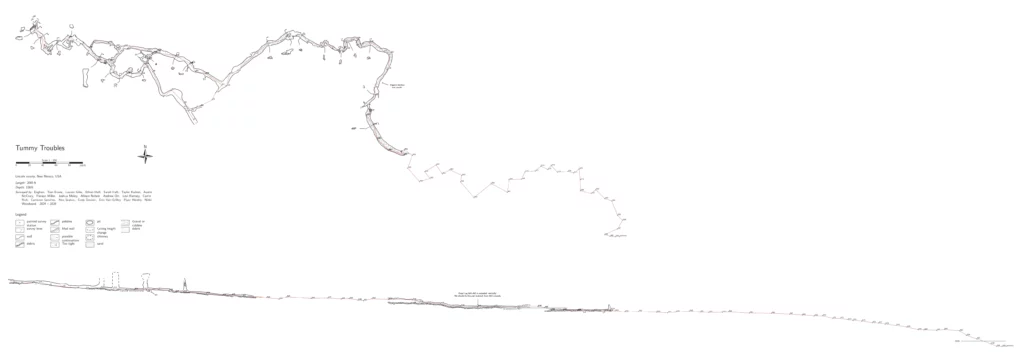
Tummy Troubles survey
Alex Seaton (TL), Ethan Haft, Sarah Haft
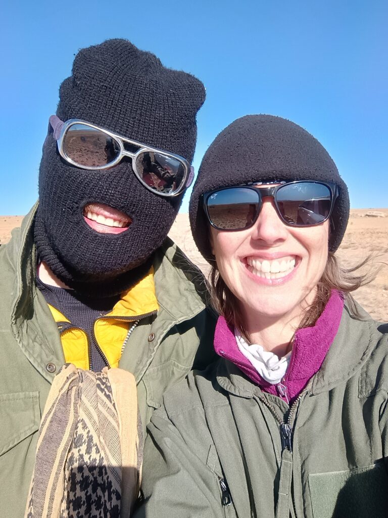
After the morning safety briefing we set off for Tummy Troubles under clear blue skies. Our objective for the day was to work on completing the profile view sketch from stations A20 to A33, picking up from where Alex, Ethan, and Piper had been sketching in October. After the drive, we got changed and reached the cave entrance at around 11am.
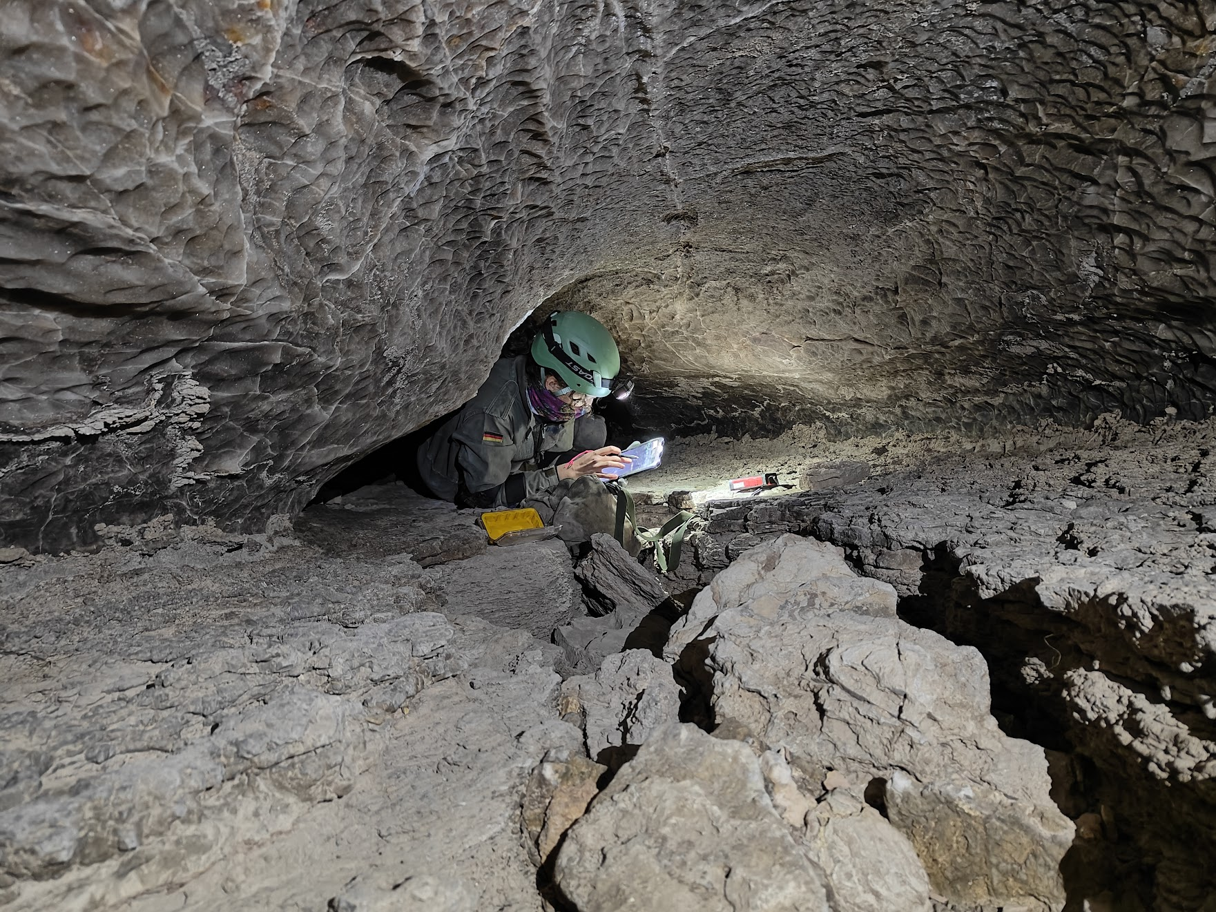
We made our way into the cave, and found station A20 without too much difficulty. Our first task was to do a backsight check and make sure that the disto was properly calibrated, which it was (phew!). Following our Topodroid crash course the previous night, Ethan & Sarah were keen to try out sketching for real. Sarah volunteered to start sketching first, so she got to work.
Our first task was drawing cross-sections at A19 and A20. After this, Sarah worked on drawing in the profile view. She also worked on new plan view since the old sketch missed some passage details.
After Sarah had sketched through to A21, it was Ethan’s turn to sketch. We had some trouble finding stations, which were worn and hard to see. We found them eventually by estimating their position from the old shot data. Another complication was that some of the previous line survey wasn’t accurate (presumably a bad disto calibration to blame) so we had to re-shoot A21-A22.
By the time Ethan finished sketching between A22-A23, it was time to finish up and head back to the surface. Despite the relatively short session and technical difficulties, it was a great training opportunity for Sarah and Ethan and they were quickly getting to grips with Topodroid.
After leaving the cave we made our way back to the vehicle in the setting sun, excited to learn what the others had been up to, and looking forward to a hot meal back at the field house.
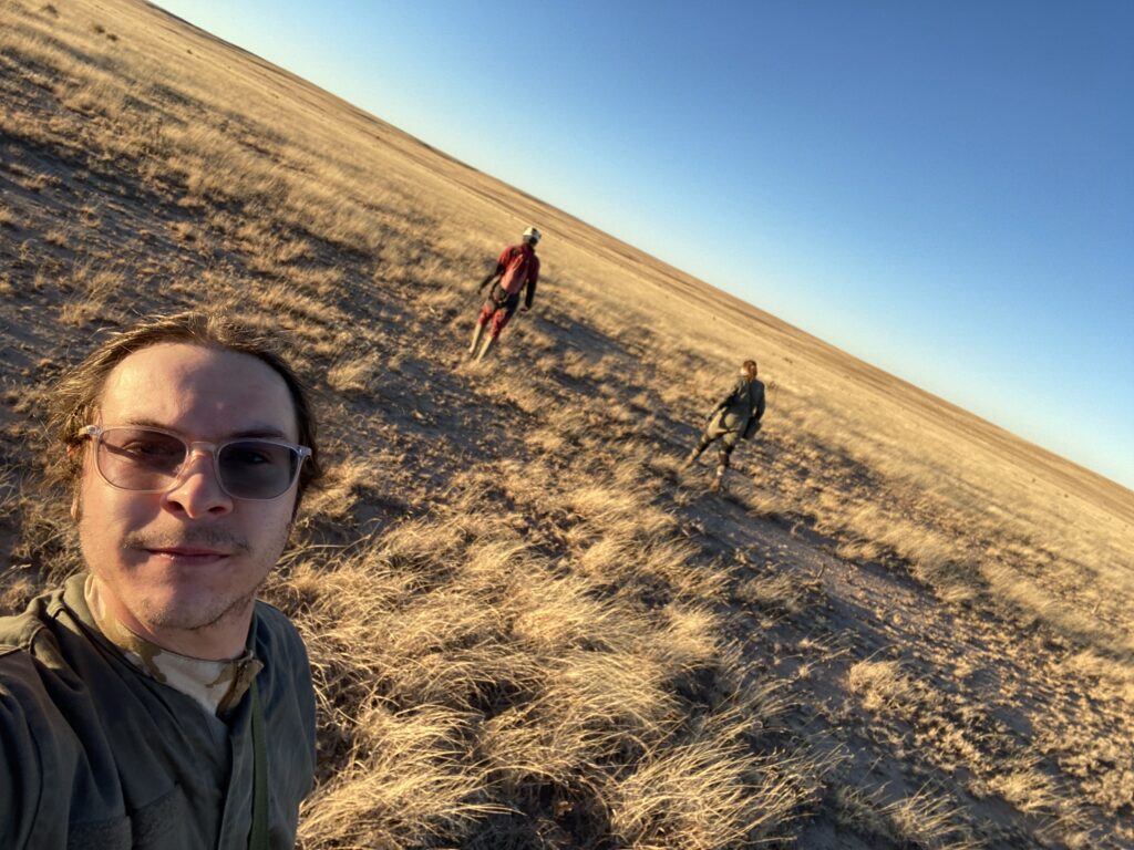
Ridgewalking
Carrin (TL), Pierson Miller
This month we switched up our approach to ridgewalking since the ridgewalking teams have been generating more points than the survey teams can keep up with. Rather than document all the features in an area, we decided to return to points identified on previous ridgewalks as needing further exploration and determine whether these features truly warrant survey. On this Saturday, Pierson and Carrin hit three points in all.
Braving an icy 25° wind, we returned to a point Carrin, Sarah, and Ethan found in February 2025. It was certainly a cave; Carrin had been in ~40 ft, through an entrance chamber and into a breakdown room, where a drop opened into fissure passage in limestone bedrock with massive dimensions, as much as 30 ft high by 20 ft wide. The drop could possibly be freeclimbed but might need a handline or even rigging, so we returned to check.
But… heartbreak! We were turned back at the same point as in 2025 because the top of the breakdown pile was so covered in fresh, glistening pack rat poop that it was a biohazard even being in there. Attempting any downclimb would place one’s hand in the thick of it, and any handline or rigging would route right through it. Major change in pack rat use of the cave since 2025!
Like idiots/good gypsum cavers, we agreed that the lead is so good, we’d be willing to come back in Tyvek suits with respirators and shovels and clean it up.
As the temperature rose above freezing and the wind died down, we headed for a lidar point that looked to be a deep gypsum pit with a small vertical entrance. In a thick gypsum layer at the base of a hillside arroyo, it looked promising, but it was not to be. Pierson downclimbed into it, only to find that it closed out after ~15 ft. Still, one less feature for the survey teams’ agenda! One more point resolved!
Short days are not on our side on this vast landscape. We wrapped up the day by routing our out-travel to hit a one-star POI on the way to a county road, which we were able to confirm as not a cave. Striking two points from the needs-a-return-visit category, strategizing a PY hazmat event, and enjoying the day despite icy temperatures felt like a win.
Sunday 11th January
We had a smaller group for Sunday as Kayla, Ethan, Sharon, and Fernando weren’t able to join us for the day. With seven of us remaining we split efforts between two teams, one surveying in Toad Hop Cave, and one exploring previous ridgewalking finds.
Toad Hop Cave survey
Alex Seaton (TL), Ethan Haft, Sarah Haft
Today’s objective for our team was to continue sketch practice with Ethan and Sarah in Toad Hop Cave by surveying some side-leads. It was also Alex and Ethan’s first time in the cave, so we wanted to spend some time exploring. After the drive, change, and hike to the cave, we arrived at the entrance at around 11:30am.
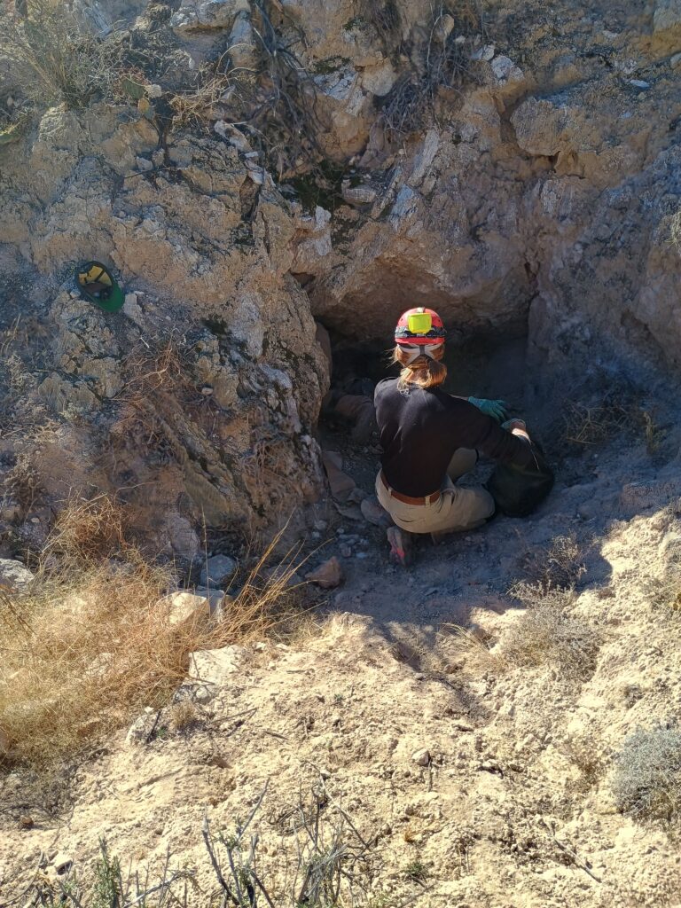
Our first task was to find a side-lead worthy of our very high standards. After making our way along the entrance crawl, we happened upon such a lead at station A8: an unpleasant and very tight-looking passage that trends east. Perfect.
As on Saturday, we alternated between Ethan and Sarah sketching. Ethan got started on the sketch at station A8, and drew out the plan view where the lead meets the main passage. Next, Sarah sketched out the beginning of the lead at A8A1. Finally, Ethan made a start at A8A2. By this point, it was getting to the time at which we needed to stop to do our sightseeing. This was fortunate, as the passage was getting very tight indeed. Given the passage dimensions, Ethan had a tough time turning around but persevered, demonstrating his gymnastic prowess.
With the survey practice complete, it was time to explore. Returning to the main passage, we climbed down into the large chamber at A9 and made our way through the crawlway to the vertical squeeze at A15. Ethan was not confident that he’d be able to make it through (or more importantly, make the return journey), so decided to wait there while Sarah and Alex explored the remainder of the cave.
The squeeze was indeed committing, but afterwards the cave opens up substantially into a large chamber. From there, Sarah led the way through a passage she had found on a previous trip, which conveniently bypasses a rather intimidating 20ft drop into the A18 chamber. Next, we continued down a spacious canyon passage (walking!) to the Toilet Bowl (A23), a roughly 10ft drop. Past this, it was a short distance to where the passage drops down into a low crawl at the infamous pool of water, which marks the current survey front. This looks very grim indeed.
We headed back to meet up with Ethan, and then made our way out of the cave. A short day, but lots of fun nevertheless!
We got back to the vehicle and had started getting changed when the ridgewalking team showed up. Cameron had some bold claims regarding the size of one of the caves they had investigated (Downward Slide). Phrases like “thousands of feet of walking passage” were mentioned. Having been on the receiving end of cavers’ tall tales in the past, Alex was wary that this could be another trap. However, his scepticism was reduced somewhat as Evan and Pierson corroborated Cameron’s account. Exciting stuff!
Ridgewalking
Carrin (TL), Evan Bowen, Pierson Miller, Cameron Sanchez
The team hit two known caves today, again with the objective of determining whether they truly warrant survey.
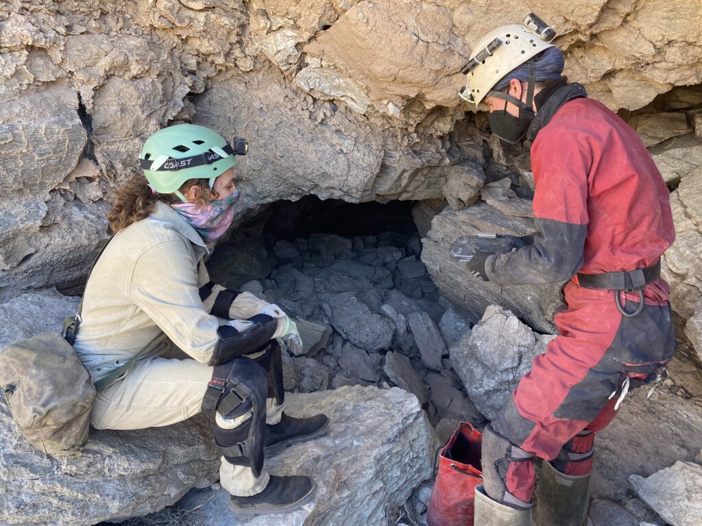
Just A Shadow Cave was checked in spring 2025 by Carrin, Levi, and Zach. On today’s trip, Evan, Cameron, and Pierson pushed farther in while Carrin checked the surrounding arroyo and hilltop for holes. The in-cave team pushed two leads: a high lead became too tight for Pierson, and Evan and Cameron were stopped in a lower-level lead by a rock blocking the way on. Passage dimensions were modest, and the team discussed whether to return with a hammer to knock out the block or move on to our next cave in the area—a fissure in limestone bedrock with large dimensions and high potential. We opted to leave the hammer work for another trip.
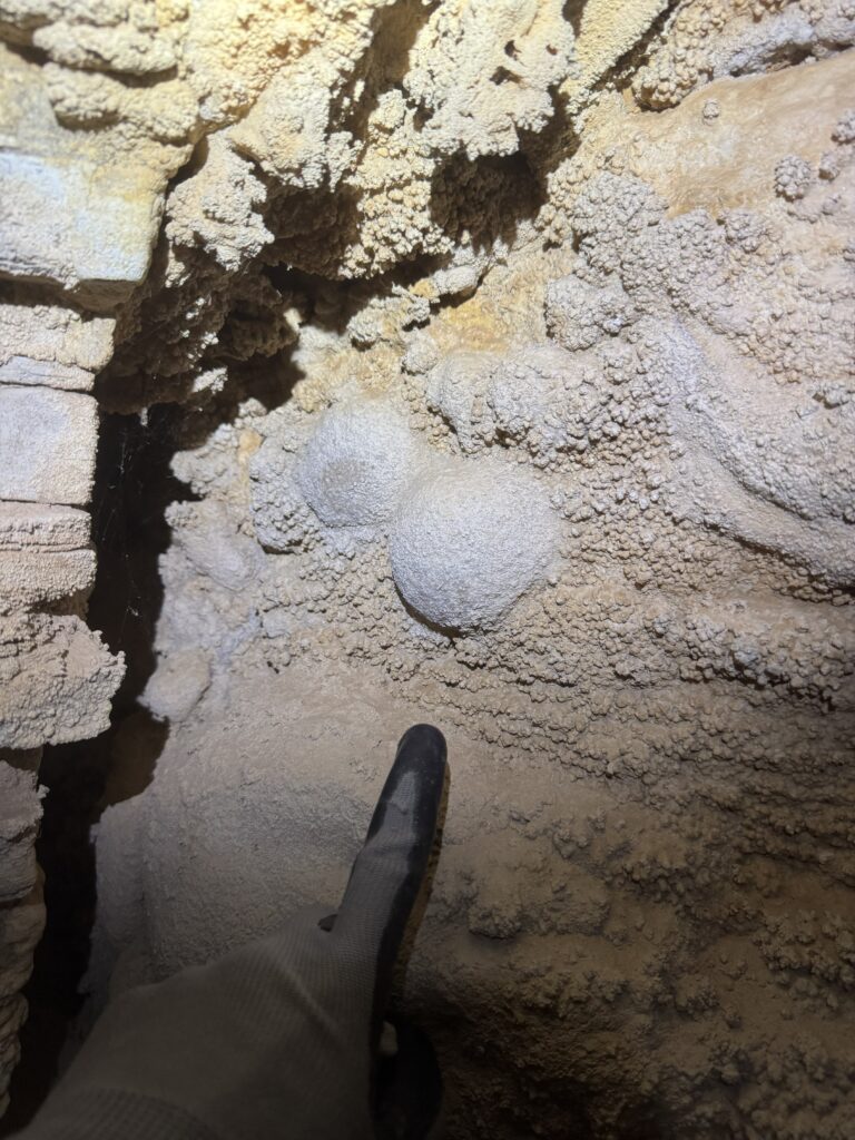
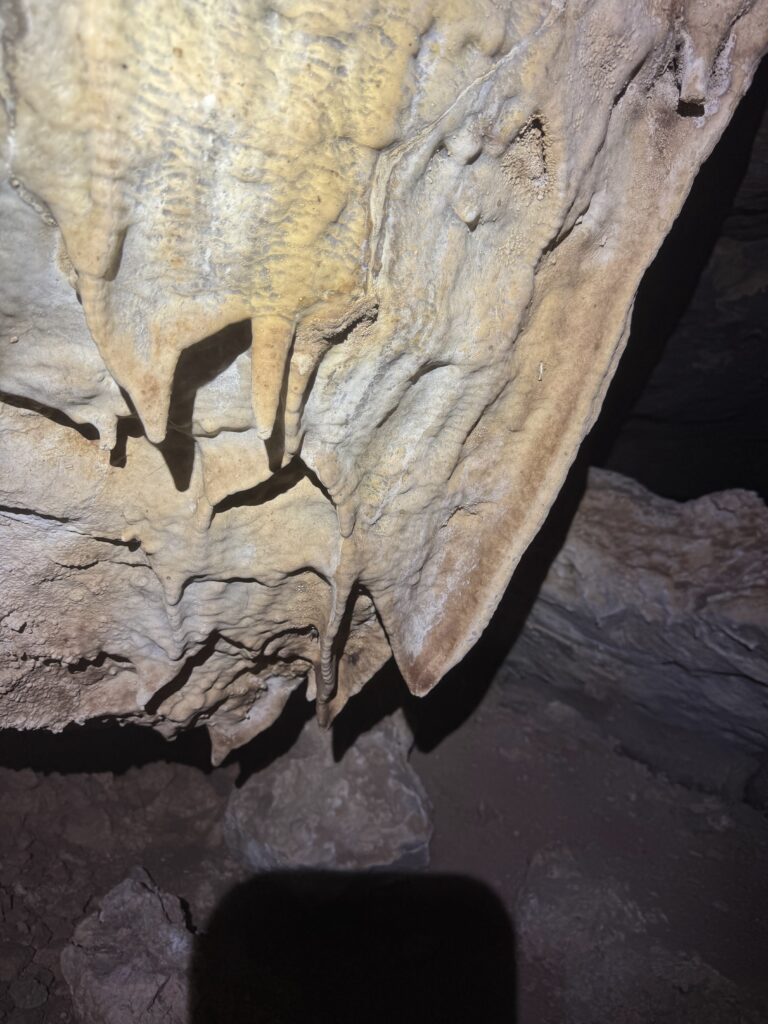
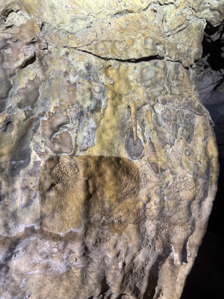
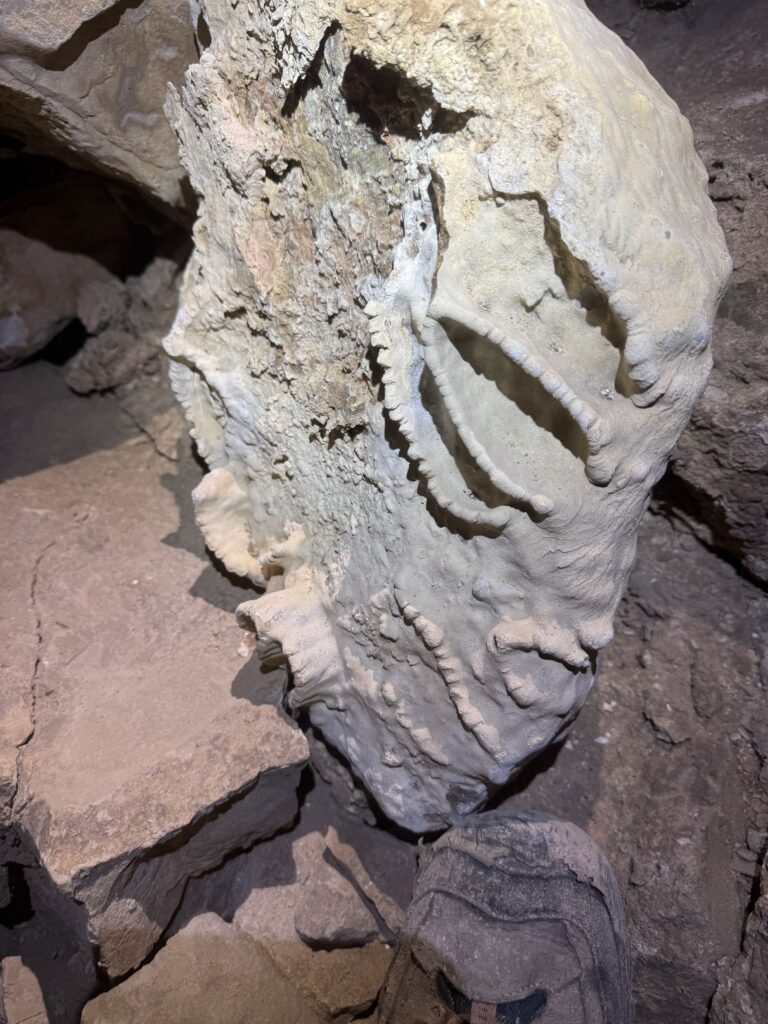
Downward Slide Cave was discovered on a ridgewalk in spring 2025 by Carrin, Levi, and Zach. This return trip revealed it to be a much more significant cave than we had previously realized. Evan, Cameron, and Pierson explored a bit down the large main passage and found dozens of side leads. The cave is warm and humid, has a skylight and calcite formations, and trends toward an area of known caves. Exciting! Survey on this one should begin as soon as possible.