Participants
- Jesse Adamczyk
- Zach Adams
- Eoghan
- Ethan Haft
- Sarah Haft
- Henry Little
- Lois Manno
- Ryan Marshall
- Pierson Miller
- Andrew Orr
- Carrin
- Alex Seaton
- Cody Sinclair
- Erin Vair-Grilley
Friday 12th December
Given the unseasonably warm weather forecast for the weekend, we decided to yet again camp for our December trip. Cavers arrived over the course of the afternoon at the PY camping spot and we got to work putting up the tent and preparing dinner. The evening meal was a reprise of the ever-popular chicken fajitas.
For the next day we decided to organise the group into four teams, with three working on survey (Toad Hop Cave, Wedgie Cave, and Sidewinder), and one team working on ridgewalking.
Saturday 13th December
After a brief rest we woke to a beautiful sunrise and slowly dragged ourselves out of our sleeping bags. After breakfast and the morning safety briefing the teams got ready and headed out for a fun day of caving!
Ridgewalking
Carrin (TL), Ethan Haft, Lois Manno, Pierson Miller
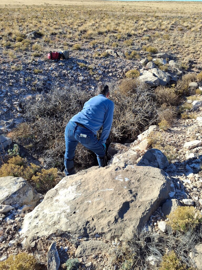
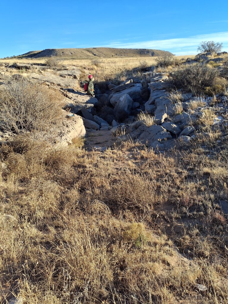
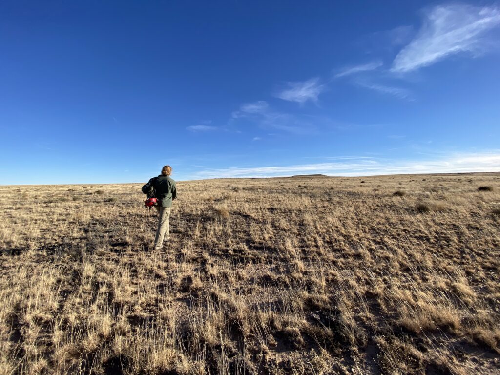
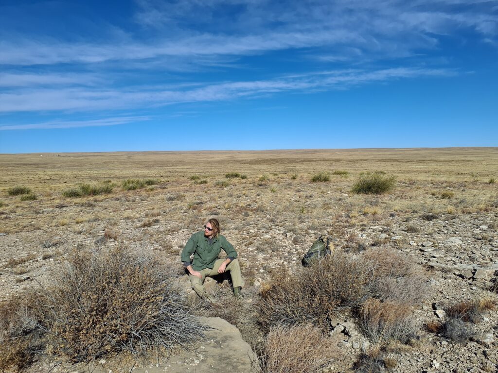
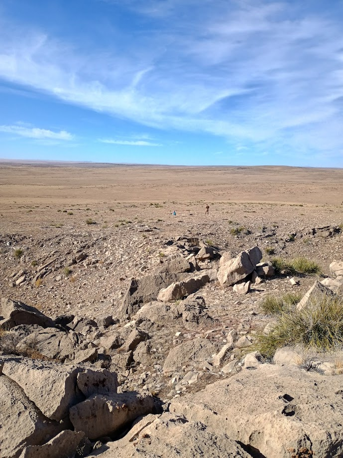
The four-person team rolled out together in two vehicles to an area northeast of camp that hadn’t been ridgewalked before but contained several interesting POIs identified by satellite imagery. Ethan and Pierson set out from the cars for a cluster north of the road, Lois and Carrin set out toward a pair of POIs to the south, following a linear sequence of depression features visible on lidar.
Southern area
Lois took to her first go with QField with aplomb, and the gypsum plains didn’t disappoint. Before lunch, we had added or updated seven POIs. Five we identified and confirmed as not caves, one we marked as a high-potential dig, and two turned out to be caves!
At lunch, the two teams rendezvoused at the vehicles to check in and strategize for the afternoon. The northern team was happy to press on in their morning area, and Lois and Carrin decided to drive a jot to knock out three roadside POIs that had not been visited on previous trips.
True to PY form, two of the three afternoon POIs turned out to be caves! The first was a shallow slabby limestone cave with two branches and two leads in each branch, and the second was an unsuspecting hole that opened into a gaping 15-ft-deep pit that will need a return visit and some rope. The last POI we confirmed as not a cave; it was a fissure-style limestone collapse that looked promising from a distance but turned out to be too collapsed to have any holes.
In total, four features that Lois and Carrin documented on this ridgewalk warrant return visits for survey and further exploration. Also, the morning’s area warrants another ridgewalk, both to the southern tip of the linear sequence (to a second marked POI we didn’t have time to visit) and farther afield from the linear features. The area is rich with potential!
Northern area
We followed Carrin and Lois out to the parking location, driving around 15 minutes Northeast of the Seven Rivers campsite. Upon arrival, we exited our vehicles, and geared up. Lois and Carrin set off South, while Pierson and Ethan headed North.
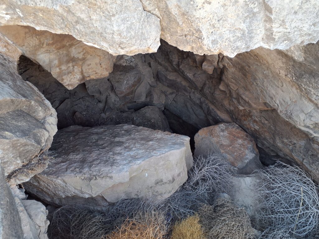
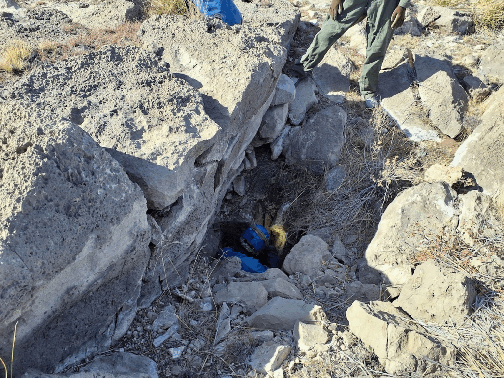
After crossing about a mile and a half of open plain, we reached some of our first points. This area was extremely favorable, and we found multiple cave entrances from the existing POI. One of the first spots discovered was a doline choked with tumbleweeds, after pulling out a dozen or so, we saw that the feature went! After this discovery (picture below), we entered the data into QField, and continued our ridgewalk.
Foliage-choked small leads were the name of the game of this area, and set the stage for the rest of our day: productive but prickly. Numerous other favorable karst features were observed and described, and almost all of them required some level of tumbleweed extraction.
After looking at all the points on the Eastern extent of our directive area, we found one of the largest features associated with the project so far!
We briefly entered the top chamber, then discussed the rest of the work to complete. It was rolling close to 12:30pm (ridgewalk team reconnect time) so we decided to head back to the vehicles for some lunch. After getting blown around the vehicles in a mid-afternoon windstorm and misplacing some cheese, we headed back out to complete the Western-most POIs in the area.
After around two hours of walking through the plains, we found that the Western POIs were not favorable features. After completing our initial directive (investigating all POI in the area), we decided that it was time to return to the large cave entrance we found. On our walk over, we discussed potential names, but none stuck. Arriving back again with about an hour of time left, we entered for around ~20 minutes. We found that under the main breakdown room, there was access to a lower chamber past a 15-20ft diagonal downclimb/chimney, and that that downclimb was covered in cactus spines. The second level had multiple crawling leads that are worth digging with further crawling passages visible beyond. Another 10ft dropoff to a third level was observed, which Pierson entered, but he found no leads at the bottom.
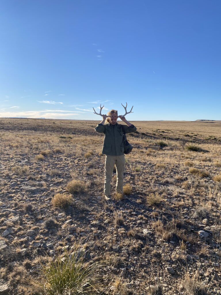
After the long hike out West and then back East to the large unnamed cave, it was time to return for the day. We continued our walk South back towards the vehicles. On the way, Pierson found some antlers he decided to hold onto, which he graciously gifted to Carrin and Lois upon reconvention of the ridgewalking teams.
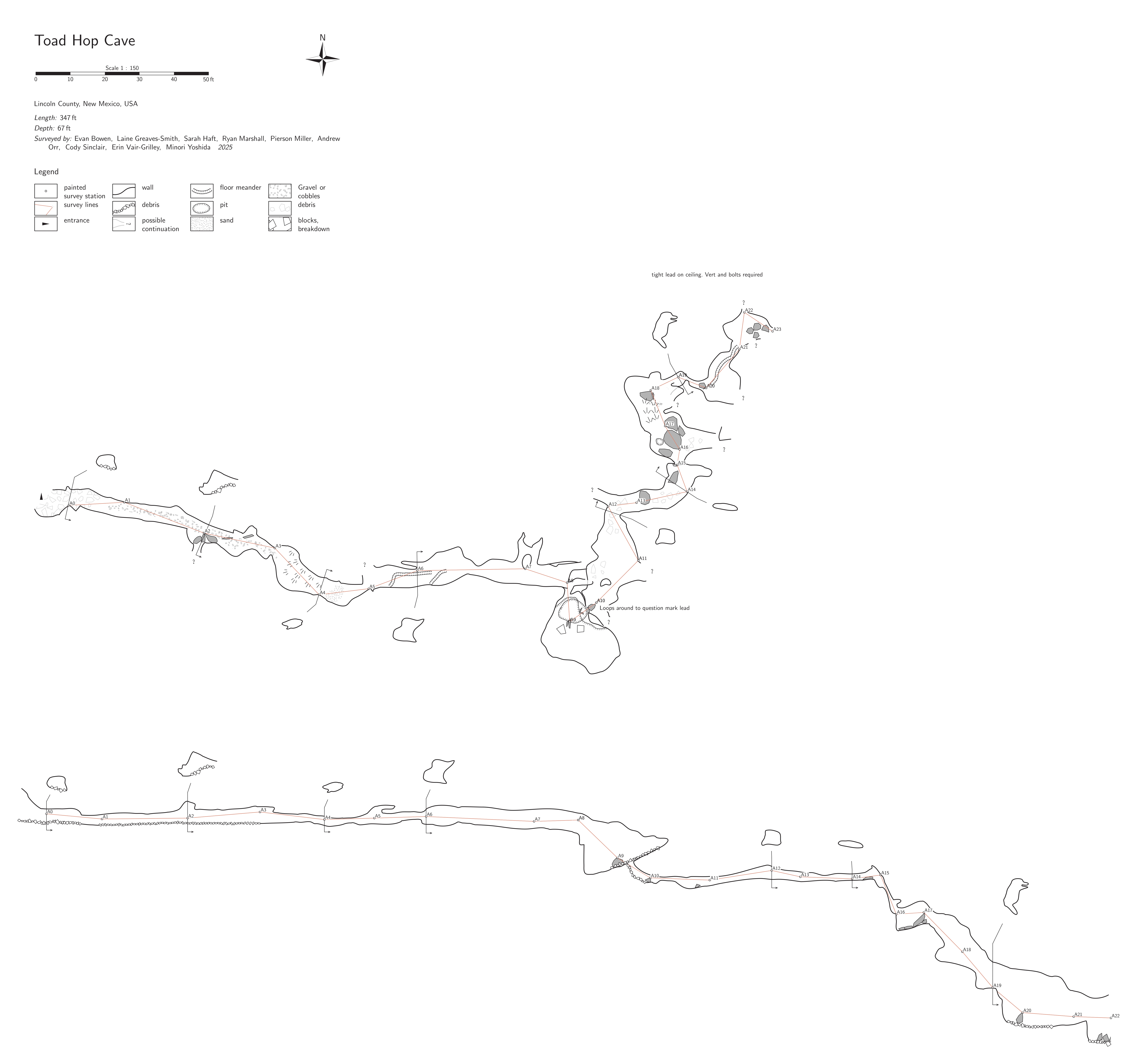
Toad Hop Cave survey
Andrew Orr (TL), Sarah Haft, Ryan Marshall
Saturday’s caving plan was to head back to Toad Hop Cave (THC) for another round of surveying.
Our first goal was to calibrate one of the Distos, so we headed to the big room where we’d have plenty of space for calibration shots. Because Ryan and Sarah hadn’t had many opportunities to calibrate a Disto yet, the process turned into more of a hands-on lesson than a quick calibration before pushing on. That ended up being a good thing: it gave both of them more time to get comfortable with the workflow, and it ensured we took the time to build a solid calibration file.
After repeating a few shots that weren’t as consistent as we wanted, we finally had a well-calibrated Disto and were ready to start surveying. We took a few backsights to confirm everything was behaving as expected, then continued into the lower section of THC, heading past the tight vertical drop.
Once we were down at the drop, Andrew started sketching the large room while Sarah and Ryan poked into a few small leads branching off from it. The geology here appears to follow a suspected fault line, and the room is full of breakdown. In the process of exploring, Sarah found a new route into the lower part of the room that bypasses the notoriously slippery, crumbly wall—an awkward spot that no one really enjoys climbing. Ryan also found a helpful lead that provides another option for getting into the lower room, and it’s likely this will become our go-to route in the future to avoid that sketchy downclimb.
Once we were past that section, we continued surveying down the main stream passage and ended at a good stopping point for the day.
All in all, it was a great day: solid calibration practice, good progress on survey, and a couple of safer, more efficient routes identified for the next trip.
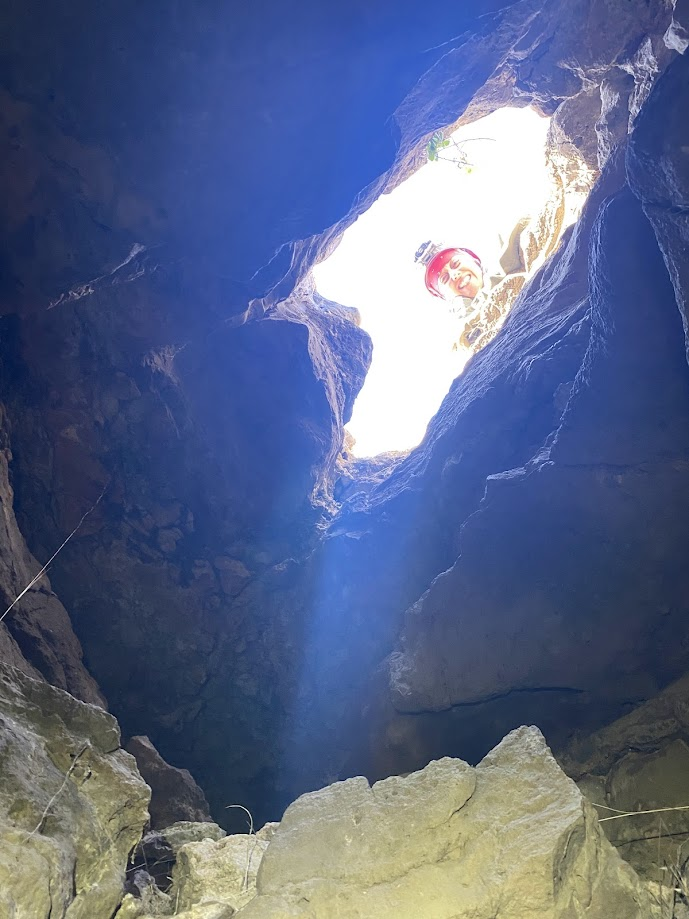
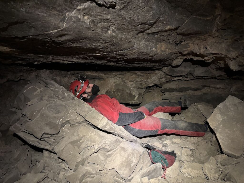
Sidewinder Cave survey
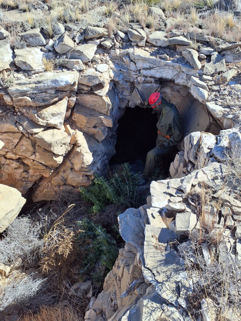
Jesse Adamczyk (TL), Eoghan, Henry Little
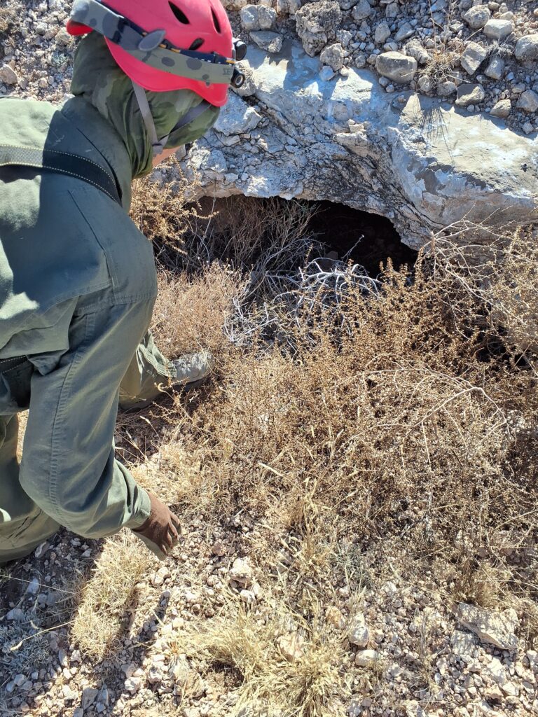
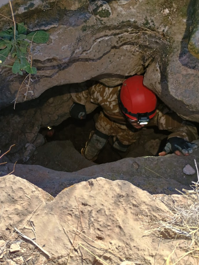
On Saturday morning, Jesse, Eoghan, and Henry quickly got ready to head out to Sidewinder cave. The team was one of the first to leave camp and head out on the 10-minute drive out to the parking spot for the cave. The road was somewhat rutted but easily driveable with a Toyota Rav4. After parking and getting all geared up with cave clothes, the team was about to head out to the cave when Eoghan noticed he had left his helmet back at camp. Fortunately the drive was short and the team headed back to camp. The early start to the day was lost as the other teams drove past while Jesse’s team was heading back into camp to grab the helmet.
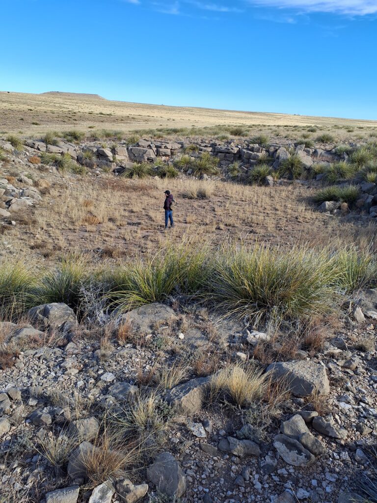
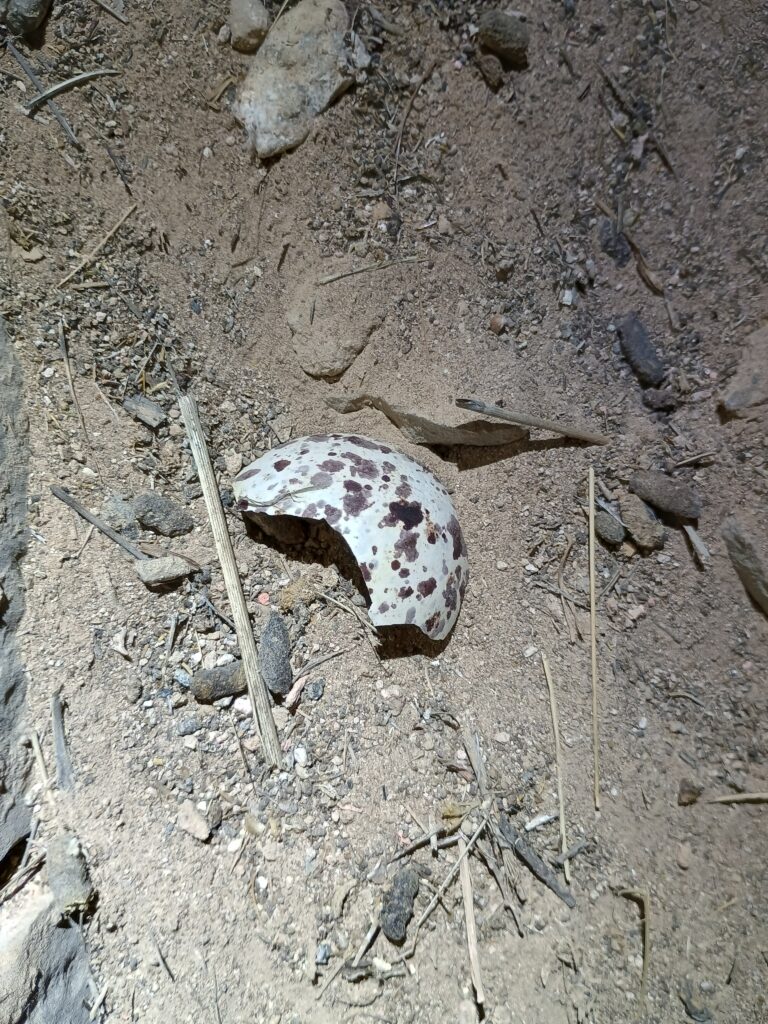
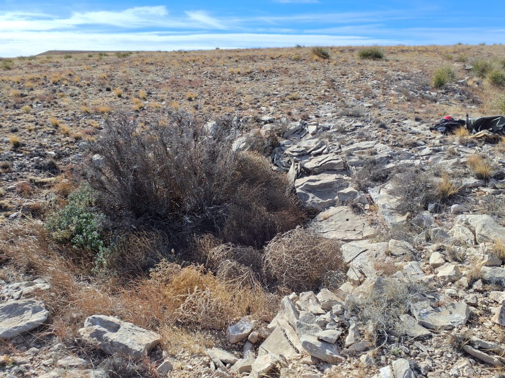
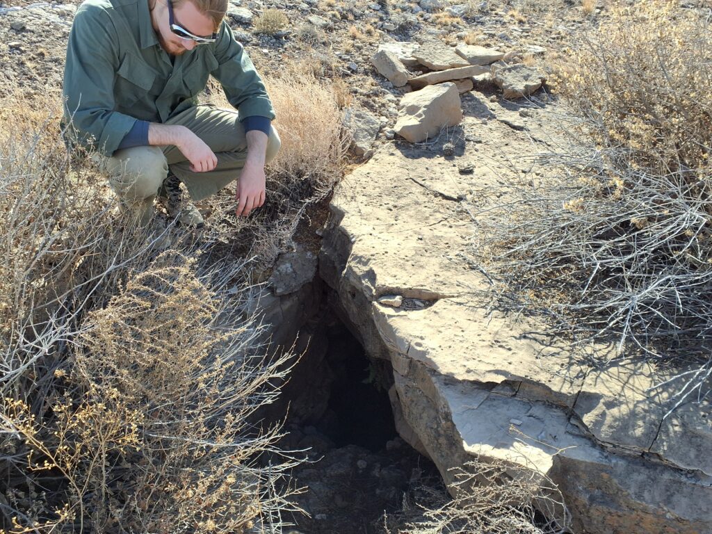
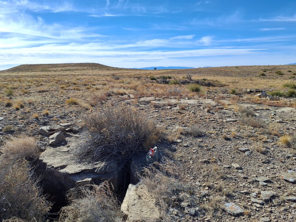
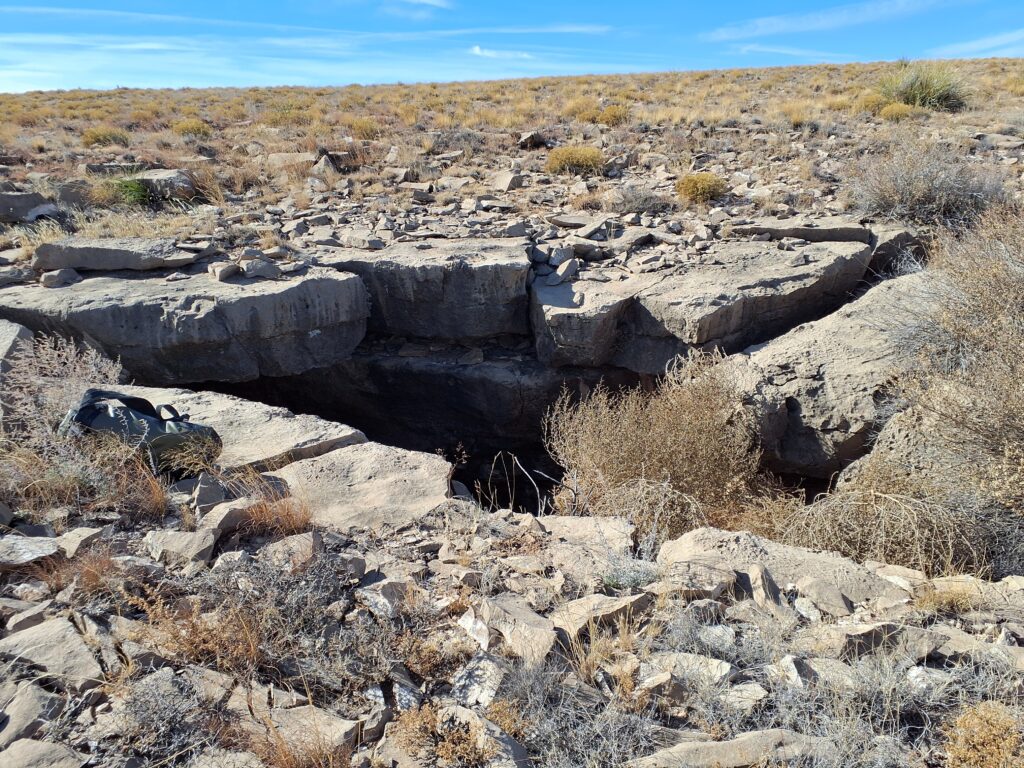
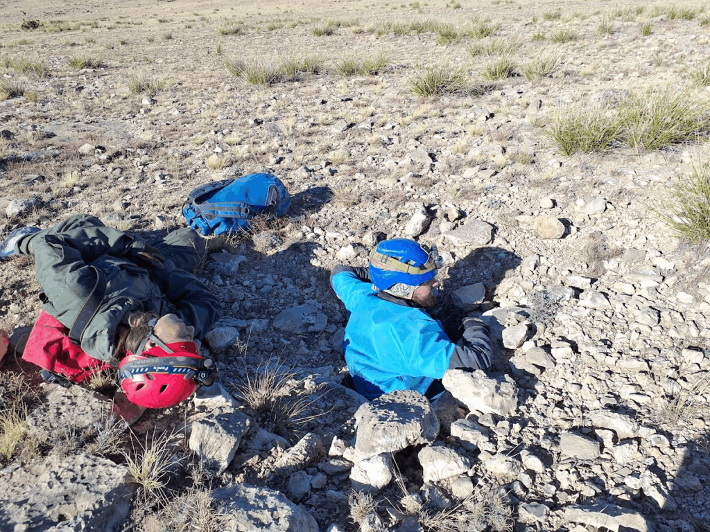
After driving back out to the cave, the team headed out towards Sidewinder cave. Due to the nature of the property boundaries, the team took a slightly roundabout way to the cave, skirting around private land. Along the way, there was a 2-star POI that the team walked out to investigate. Unfortunately the POI turned out to be a shallow depression without an obvious cave entrance (see below). It likely that water drains from the field to this location but just slowly seeps into the ground.
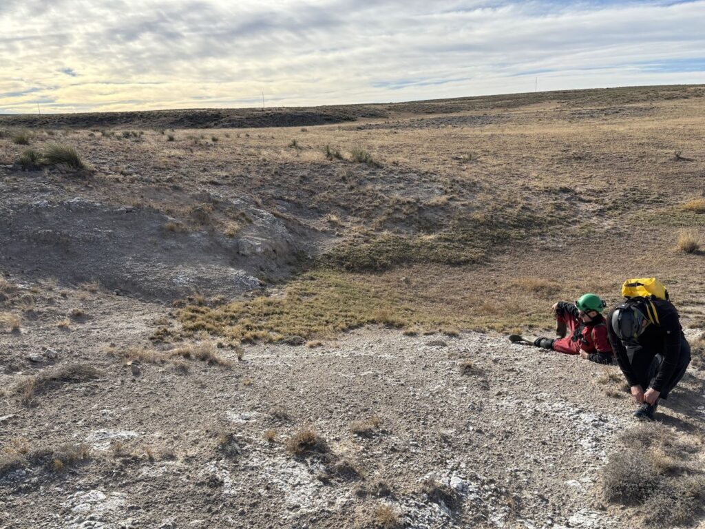
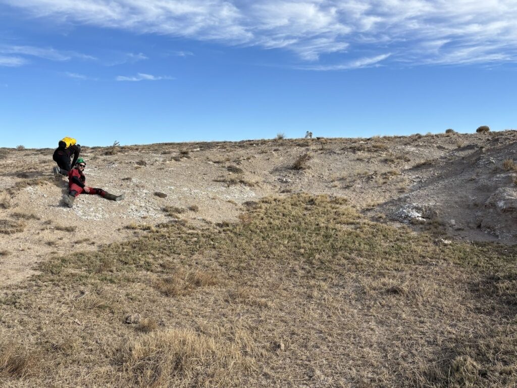
After a quick review of the POI, the team moved on to Sidewinder cave. The cave was only about 2000ft away, so the team quickly walked across the field. Approaching from the North, the cave was virtually invisible even from only a few hundred feet away. The team got to the cave entrance and got geared up to go into the cave.
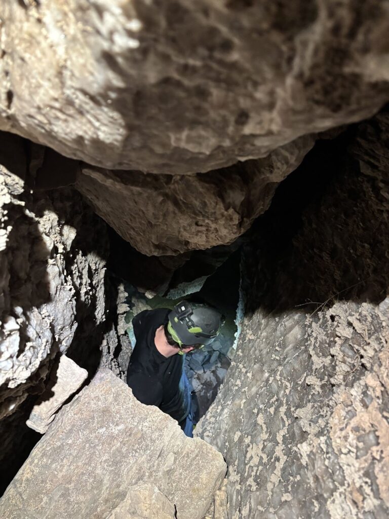
The plan was to calibrate the Disto in the cave and then survey as much as reasonably possible. Henry entered the cave first and climbed down the initial drop. A handline was rigged on the previous trip to this cave, but this was deemed unnecessary due to the height of the cavers on this trip. Less experienced cavers might still want a handline (though this cave is not ideal for beginner cavers).
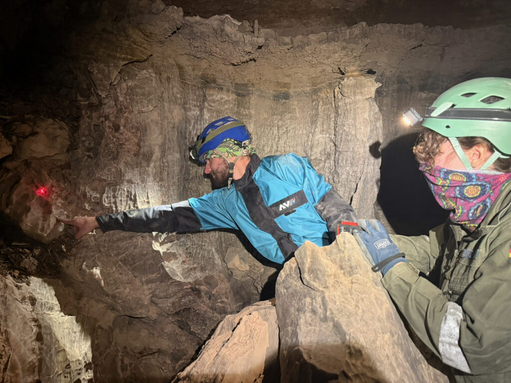
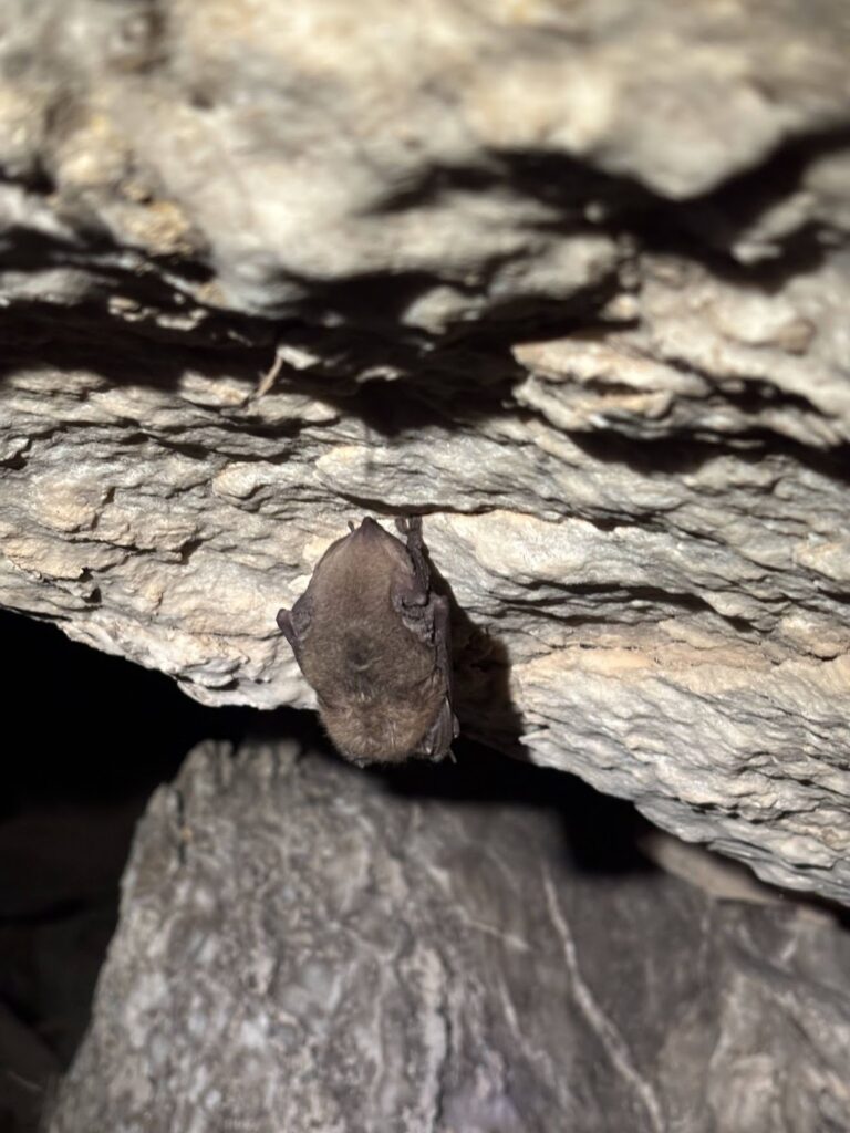
At the bottom of the drop was some stream passage with standing room where the team regrouped. Jesse and Eoghan started planning the Disto calibration and figured out where and how to shoot the points. Henry went downstream a few feet and found a bat on the wall. After going a few more feet forward, Henry found another bat on the wall. Because of the density of bats, the team decided to leave the cave so as not to disturb the hibernating bats.
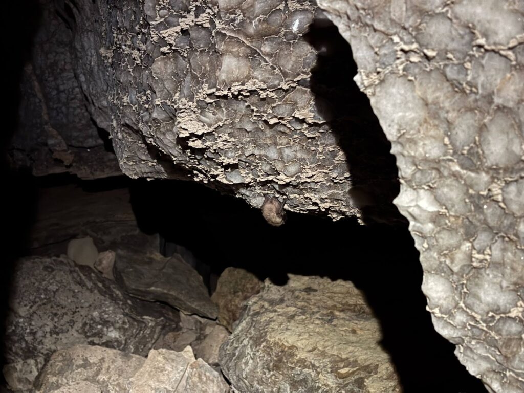
While scrambling out of the cave, Henry spotted another bat at the top of the drop — another reason to leave the cave.
At this point it was nearing 10:00am. Outside of the cave the sun was warm and the area around the entrance to Sidewinder was protected from the wind. Jesse shot calibration points, Eoghan spotted the stations, and Henry collected the data on TopoDroid. The first few points went quickly and smoothly. Average errors were kept very low and this gave the team a boost of confidence that the calibration would be completed quickly. The struggles began once the team tried to shoot points downwards in the Southeast and upwards to the Northwest. Every set of shots would result in errors with values that would increase the average errors much higher than the desired minimums. After roughly 3 hours and many deleted calibration points, the 0146 Disto was finally calibrated to the desired error and coverage values.
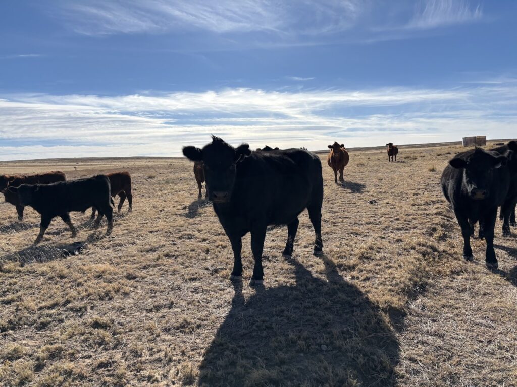
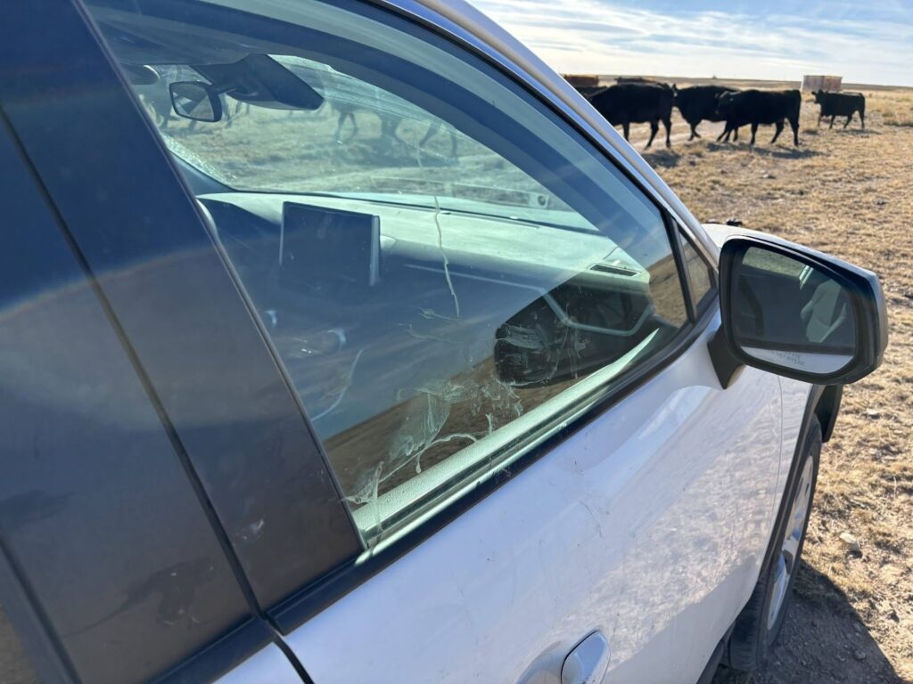
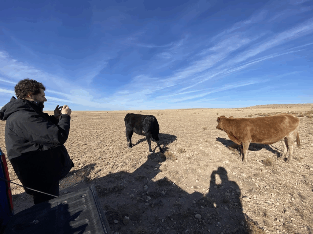
Due to the hibernating bats in Sidewinder cave, the team decided to head over to Toad Hop Cave, which was just down the road from where the car was parked. Upon returning to the vehicle, a group of cows had gathered around the car, slobbering all over the windows, mirrors, and backup camera. Cow lick marks were present on all sides of the car.
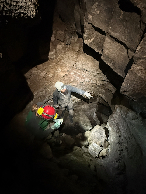
The team hopped in the car and drove over to where Andy had parked his car. Eoghan and Jesse had not been to Toad Hop Cave, so Henry led the way across the field to the cave. The team arrived at the entrance of the cave about 20 minutes later. Crawling into the cave, Henry was listening for the voices of Andy’s team up ahead. Henry stopped at the top of the downclimb constriction as he could hear the other team in the cave. It was unknown at the time but the team already inside of the cave was caught completely off-guard at the sound of other people nearby. Henry yelled out to Andy to let him know that we were at the top of the constriction. Andy said we could come on down and join the party.
Jesse, Eoghan, and Henry met up Andy, Ryan, and Sarah in a big room. It was perfect timing as Andy’s team was about to take a break from surveying to make a trip down to the sump. The team of 6 headed down through the stream passage and various drops until they were at the bottom of the cave. The sump at the bottom is full of clear water and has an air space above that is greater than 12 inches. A caver would likely be able to push this passage on their back with plenty of space to breathe.
After a few minutes at the sump, the two teams headed back up to the survey area. The climbs up and away from the sump required some complex stemming techniques.
Once back at the last survey station, Andy’s team continued surveying while Jesse’s team headed back up and out of the cave. Jesse, Eoghan, and Henry walked back to the car, changed, and headed back to camp for the evening. The team was the first ones back at camp, but other teams arrived about 20 minutes later. Even though it was a relatively uneventful day, the team was happy that the Disto was calibrated and some fun recreational caving was had.
Wedgie Cave survey
Erin Vair-Grilley (TL), Zach Adams, Alex Seaton, Cody Sinclair
After spending the night camping in the field during an unseasonably warm spell Erin, Cody, Alex and Zach went caving in Wedgie cave. The weather was very pleasant given that it was mid-December so the walk to the cave was quick and enjoyable. Once in the cave the group of four traversed the entrance series, the Wedgie drop and through the first few crawls until they came to a “large” room where several distos would be calibrated. Erin and Cody calibrated one while Alex and Zach calibrated two others.
Main passage survey
Once Erin and Cody’s disto was calibrated they headed further into the cave to continue to push the survey front. Following the passage lead them to the “tight and gnarly” place noted on the survey. Cody performed a bit of rock gardening resulting in a slightly less “tight and gnarly” section. Continuing on they started survey at station A82. The passage was comfortable enough, but still cozy. Cody set stations and Erin walked him through the basics of survey. The passageway from A81-A84 was cleaned up on the survey, this was marked as a lead and a passage, but it’s really one passage with a nearly continous pillar cutting through it making it appear as two separate routes. There are holes in the pillar though and you can peer through and see that it’s all connected and going to the same place.
This part of the cave is very very dry, and the soil was dust and powdery. The passage got smaller as they continued, slowly making progress surveying they came to a room where they could both sit/lay and turn around. A87 is in this room, the room has lots of little off shoots that quickly pinched off giving it a finger like look. There was one finger that had a hole in it, through which a little bit more cave passage could be seen, but Erin was unable to squeeze through the constriction, it didnt look promising and was marked TT.
A88 was the final station set, the cave continues past this point, going in head first you’re faced with a 40 degree or so sandy slope with maybe 8 or 9 inches of space before the ceiling. Once getting through this the passage becomes just under shoulder width and is a comfortable belly crawl. There was a place where Erin could turn around and continue down the passage feet first. Feet first was necessary because the passage became super narrow, just over an Erin boot (size 6.5 boot) in width. She wiggled in for about 5 feet to see if it got wider, but looking down past her feet it just stayed the same miserably tight passage for at least another 10-15 feet.

Erin returned to Cody and filled him in. He was not going to fit so they ended the survey there and went back to a near by lead. Erin once again went in feet first due to its very narrow width, looking back over her feet requred the helmet to be removed as the helmet was wider than the passage. After getting about 6 feet back and end was visible. The passage just pinched off. Another lead finished. Onto the next, listed on the survey as “Pierson went in and said it’s small”. Can confirm it’s small, Erin had to once again squeeze past a constriction that was very tight in the hips and butt. After that there is a space to sit and turn around, the passage goes a little bit further before pinching off too small for continuation. That lead was not surveyed due to time constraints. Erin and Cody headed out of the cave and on the way out they met up with Alex and Zach who were also on the way out. Overall it was a successful day.
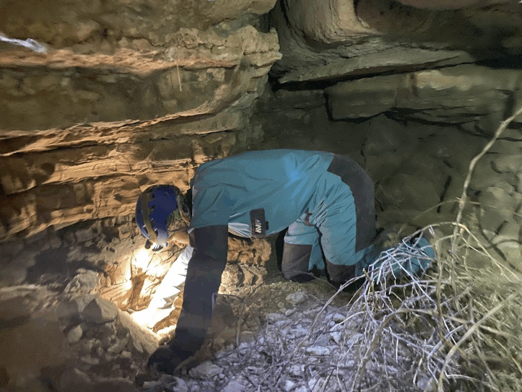
Sketch cleanup crew
With the distos calibrated, Zach and Alex discussed their objectives. Our plan was to work on cleanup of bits of the sketch. In particular, we wanted to fill in some missing sections of the profile, and add some cross sections. This was also a good opportunity to add any passage detail to the sketch which the previous teams might have missed.
Our first stop was at station A28, where there was a brief section of profile missing between A28-A32. This turned out to be quite a tricky spot to draw properly. There was a lead in the ceiling which complicated things.
After battling with Topodroid during the calibration session, Zach had reached his OSHA mandated Topodroid exposure limit for the day, so Alex got to work on sketching this section.
We spent a while investigating the lead in the ceiling. It looked promising, but unfortunately all ways on were blocked by large limestone blocks. We figured it would be foolish to try to shift any of them, given that they were hanging precariously above our heads.
Alex finished up the profile sketch and a cheeky cross section. With that complete, we were ready to move on. The next section of profile sketch that was missing was between A44-A52, so we headed over. We traveled slowly, checking for missing passage detail in plan & profile view along the way and were able to add in a few details that had been missed (floor type, boulders, etc.).
We got to A44 and Alex started work on sketching out the profile. This section of cave is narrow, but very tall, giving us a rare opportunity to stand up. What luxury! Zach hung out at A44 and took a nap, while Alex continued sketching. He was able to sketch up until station A47 by the time we hit our turn-around time. This was fortunate, since there’s a very tight lead that needs surveying at A47.
We started back towards the entrance, but ran into an unexpected hiccup along the way. As he moved from A39 to A38, Alex crawled over an unassuming limestone block on the floor. This turned out to be supporting a number of other limestone blocks in an infeeder in the ceiling. As he put his hand on the block, the whole pile shifted and began to fall. Fortunately, Alex was able to quickly put his hand out and hold them back before they fell on him.
We decided to sit and wait at A38 for Erin and Cody to arrive to warn them about this hazard. It wasn’t long before they arrived, and we spent a few minutes very carefully getting them past the rock pile. This will need to be stabilised on the next trip into Wedgie cave.
That aside, we made our way back to the entrance without any other issues, and headed back to camp.
With everyone back at camp we got started on dinner, a hearty Minnesota chili suggested by Carrin.
There was a meteor shower that night, so after dinner we spent some time stargazing.
Sunday 14th December
Ridgewalking
Carrin (TL), Ethan Haft (author), Ryan Marshall
After a brief two mile drive North (from camp), we arrived at our parking spot along county road B020. Our directive for the afternoon was to ‘clean-up’ the area Northwest of the Seven Rivers Ranch. Upon exiting our vehicle and preparing our gear, we were met by two curious cows that sprinted up to us! They lingered for the duration of our gear-up, invited more of their bovine friends, then proceeded to follow us in larger number into the Lon plains.
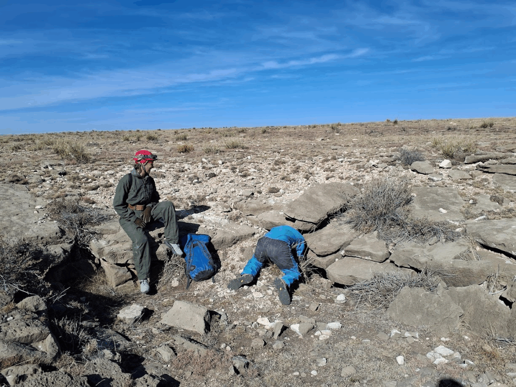
After a half mile walk West, we found the first points of interest. We identified numerous “not caves” marked by previous teams, and identified a few features that were not found by previous ridgewalkers. It was noted that various features in this area were not physically entered because of the presence of rattlesnakes last season – we entered those features this trip.
After confirming numerous “not caves” and adding additional information on QField for the newly-entered features, we continued northward to the remaining unexplored POIs. As we hiked, we located numerous insignificant (very tight) warm moist blowers (WMB), but none were human-size, and none appeared to connect to any other surficially accessible features in the area.
Ryan and Carrin left no stone unturned, and at any indication of breakdown or void space, they were sure to investigate thoroughly…
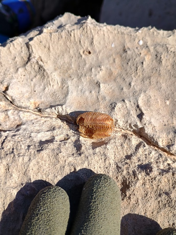
As we made our way North towards a four-star POI, we encountered and entered various small features. One of which was previously described as a “not cave”, which our team upgraded to a dig after Ryan spent some time in the feature to expose further passage than what was previously described. Around this time, Carrin and Ryan noted a praying-mantis egg sac that they thought was exceptionally pretty.
Numerous insignificant karst features (breakdown dolines, WMB fissures, and tight diggable entrances) were noted and added to QField between the southern-edge and northern extent of the designated field area. There was a single satellite-discovered one-star POI that did not have any discernible surface feature associated with it that was deleted, however, additional features were found and described nearby.
on the surface, he entered to find the feature is not continuous.
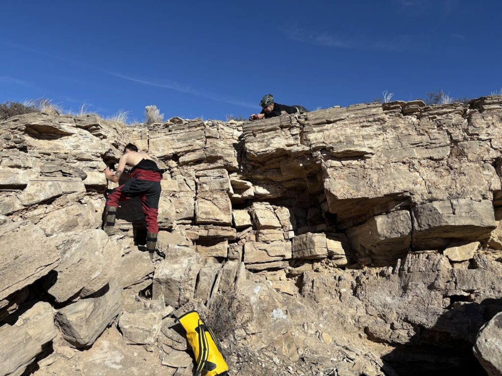
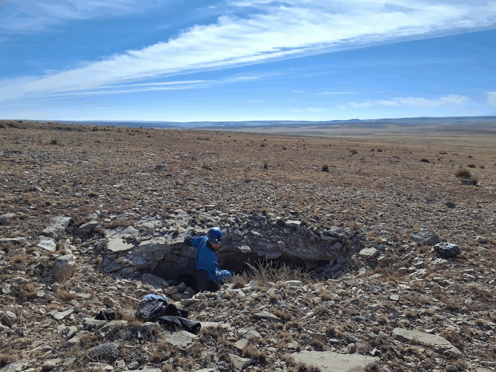
The highlight of our day was a four-star POI described as a 15-20ft chimney that was not previously physically entered. Upon arrival at the chimney, Ryan led the way, followed by myself, while Carrin cheered us on from the surface. The bottom chamber was not extensive, and there were no obvious leads. Ryan, however, identified a section of solution collapse, and dug to reveal a grim-but-gaping lead that blew strongly with cold air! Upon further inspection of our excavation space, we recognized we were laying on top of ticks and spiders, and after sending the largest tick we’ve ever seen to Valhalla, we decided to make our egress.
After investigating the four-star chimney and entering the resulting data into QField, we decided to hit one last section before returning to the campsite at 3pm. We walked further West to a number of small LiDAR depressions that were not marked as POIs. Nothing extensive or extraordinary was found, but data was collected nonetheless. After that, we hiked the mile-or-so back to our vehicle, and returned to camp for departure.
Geological Discussion
On our way back, we discussed the potential geological implications of “warm-moist blowers” (WMB). Carrin pointed out the ciénega, or the foliage-dense valley bottom feature found throughout the field area – Ciénegas (or wetlands) generally overlay hydrological conduits (places where water flows), and are indicative of subsurface porosity and groundwater flow. The presence of multiple WMB with no discernable provenance (i.e. extremely tight WMB that were found with no other leads, or any other obvious exposures nearby) may indicate that WMB are driven by a deeper subsurface process, such as the one driving the presence of the ciénega in the surrounding valleys.
Isolated fissures and cracks are unlikely to capture enough air pressure, water, and heat themselves to present the characteristics observed by WMB. Characteristics of WMB include: emission of warm humid air, presence of surface moisture and droplets, and the presence of moss within the feature themselves. Further investigation is warranted and could even be a worthy geological research project – i.e. examining temperature/air pressure/morphological data of individual WMB features between seasons/each other. This data could help illuminate how and why WMB are formed.
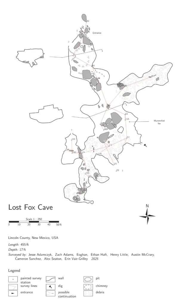
Lost Fox Cave survey
Jesse Adamczyk (TL), Zach Adams, Henry Little
On Sunday morning, Jesse, Henry, and Zach walked from camp over to Lost Fox Cave. In total it took about 10 minutes to get over to the cave. Henry and Zach went in first and explored a few passages around the entrance. After looking around at the entrance chamber for a few minutes, the team went over to the C-survey which needed the majority of the sketch cleanup. The survey required additional detail as there were some pillar and breakdown features that were not captured clearly. Jesse shot points and sketched while Henry and Zach explored the various rooms.
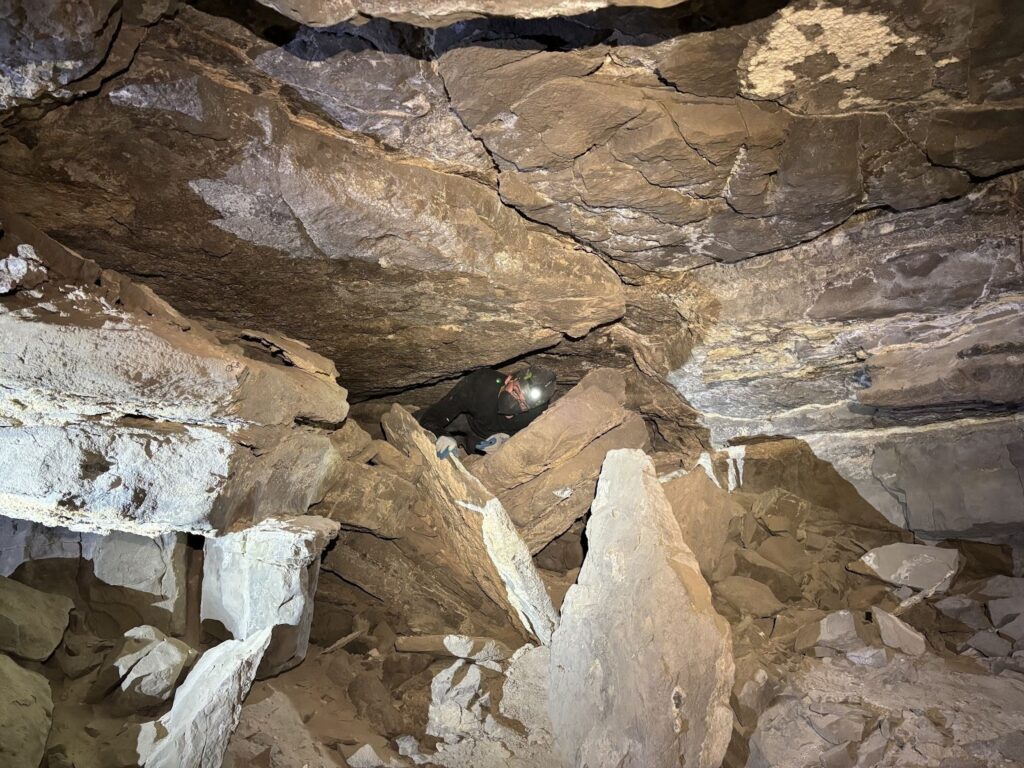
The survey was fairly uneventful but progressed steadily. Jesse and Henry found that one of the rooms had not been adequately surveyed. Jesse walked Henry through some basic survey and sketch using the Disto and Topodroid. Henry completed the unsurveyed sections of the room. After mopping up the known survey areas, Henry discovered a lead under some breakdown. Henry went into the lead first while Jesse followed — Zach stayed behind as the lead was through tight dusty breakdown. Henry had discovered another room of the cave! In one corner of the room was a sandy lead that could easily be dug out. The room has significant dig potential as breakdown could easily be moved out of the way to expose additional passage. Additionally, the proximity to camp and size of the cave would make digging in this cave ideal. After a few minutes, Henry and Jesse crawled out of the new lead. Jesse shot a few points up to the lead and labelled it as the D-survey for future reference. It was nearly 2:30pm at this point, so the team headed out of the cave and walked back to camp. It was a successful day of survey: the existing portions of the survey were cleaned up and additional cave was found! Another team should return to Lost Fox Cave to finish the D-survey and push leads.
Toad Hop Cave survey
Andrew Orr (TL), Pierson Miller, Cody Sinclair
After witnessing a beautiful meteor shower on Saturday night, Sunday morning came too quickly with the promise of more caving.
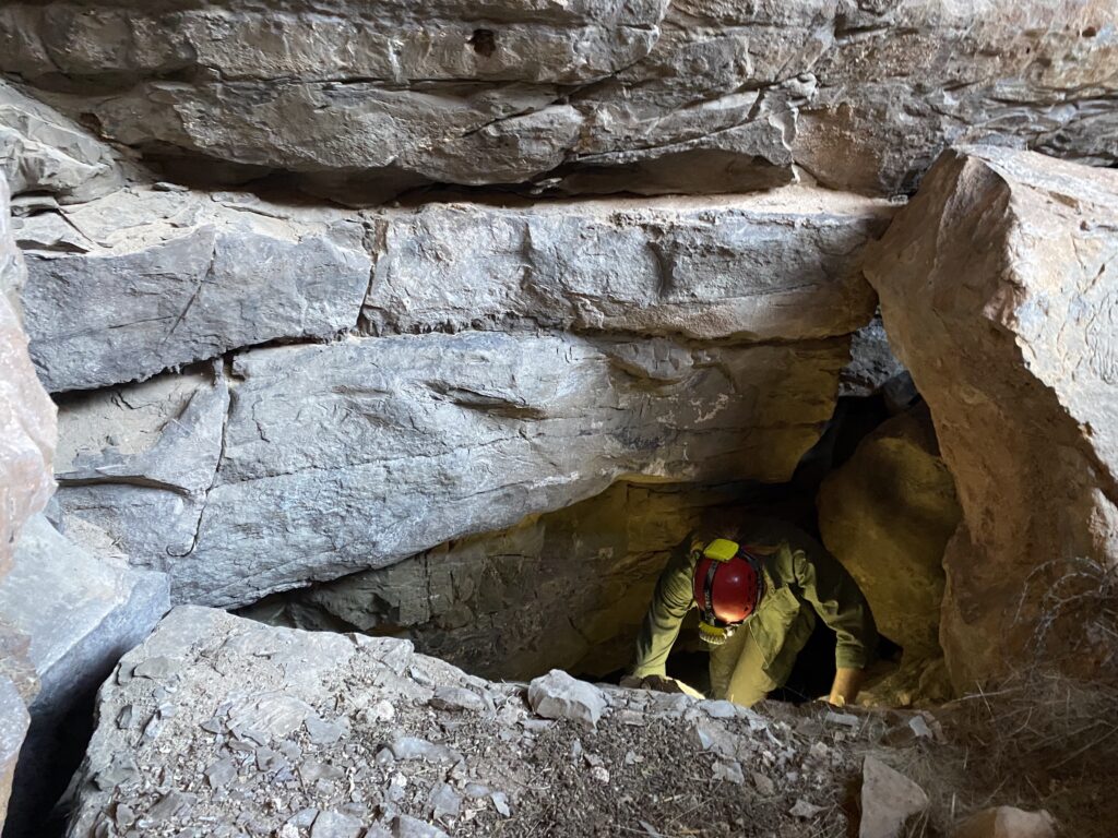
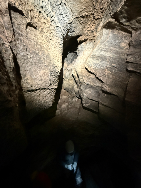
We began where we had left off on Saturday at THC and started working our way further down the main passage. Right off the bat, there was a small room (with high ceiling), that had a paleostream channel up near the roof. It definitely looked promising so it was marked on the map as a lead. This would require bolts and a gnarly traverse if it’s even possible to get up there (see picture). It’s possible this may connect to another lead further down in THC where there is an intersection of several leads.
Since it was a shorter day of surveying, we tried to make the best use of time we had and push the survey as close to the water section as possible so it would be feasible to push the water section on the next trip. We ended up getting pretty close to this goal and probvably have ½ to ¾ of a day left until we reach the water in THC.
One of the neatest parts of the day was a fold in the gypsum that Andrew found. In one section of the cave, we encountered a small but striking example of plastic deformation in gypsum—a rock type that’s common in New Mexico evaporite caves and is unusually “soft” in a geologic sense compared to limestone. Gypsum can deform ductilely (bend and flow rather than crack) under relatively low temperatures when it is subjected to sustained stress, especially in a humid cave environment where moisture can further weaken crystal boundaries.
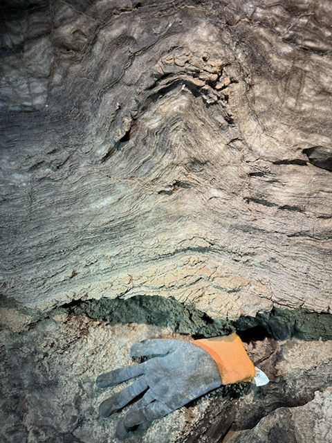
The feature itself is a symmetrical fold expressed as a gentle, rounded arch about 12 inches (30 cm) high and roughly 6–8 inches (15–20 cm) across. Its symmetry suggests the gypsum layer was shortened by compressive stress that was applied fairly evenly from both sides, allowing the material to buckle into a balanced fold rather than producing a one-sided drag fold or a brittle fracture. Instead of breaking, the gypsum accommodated strain by crystal-plastic processes (slow reorganization and slip within and between gypsum crystals), producing a smooth, continuous curvature.
At the end of the day, we headed out and met up with everyone at the agreed upon meeting place at 3pm to say our goodbyes.
Tummy Troubles survey
Erin Vair-Grilley (TL), Eoghan, Sarah Haft, Alex Seaton
A-survey
Alex, Eoghan, Sarah and Erin were tasked with going to Tummy Troubles, Erin and Eoghan were one team and Alex and Sarah the other. All four traveled into the cave together, Erin and Eoghan made a quick stop to close the survey loop between station A9g and A18, then Erin and Eoghan headed further down the A survey to continue plan and profile sketch.
Their goal was to sketch as far as they could along the line survey that had previously been completed. It took about 30-35 minutes to travel from A18 to A47. Plan and profile sketch began at A47, Eoghan and Erin worked together to relocate or approximately relocate the previous survey stations, which had gotten covered in mud since the line survey was done.
To relocate each survey station, Erin would refer to the line survey data and use those numbers to approximate where the point was with the DistoX. Then Eoghan would try to find the survey marker. If it couldn’t be found, a temporary survey station was set (A50a was the designation for the temporary A50 survey station for example).
After each station was relocated, Erin went to completing the plan and profile sketch and Eoghan turned on his audiobook, Goldfinger by Ian Fleming, for them to listen to. This pattern of finding the station then sketching and listen to the audiobook continued for about an hour and a half before it was time to exit the cave. They stopped at A52 and were working on a cross section, which wouldn’t correctly work in TopoDriod, but otherwise were ready to move onto A53.
B-survey
After Erin and Eoghan left, Sarah and Alex got started on survey in the B-survey branch. We first worked on tidying up bits and pieces of the sketch from B1-B4, adding some cross sections and passage detail in plan view.
Sarah was interested in giving Topodroid a go, so once we reached B4, Alex began explaining the process of sketching, and how to do this in Topodroid. Sarah was just getting started on sketching her first bit of cave when disaster struck: Topodroid deleted all of the sketch we’d just done! After some troubleshooting, we realised that the tablet had a newer version of Topodroid installed, which evidently had some new and exciting bugs. This must have been the tablet that Andrew was using in THC in October, since he reported a similar issue.
Given that we weren’t confident our data would be saved, we opted to switch to line survey. Our new objective was to line survey through from B6 to (hopefully!) a connection with A survey.
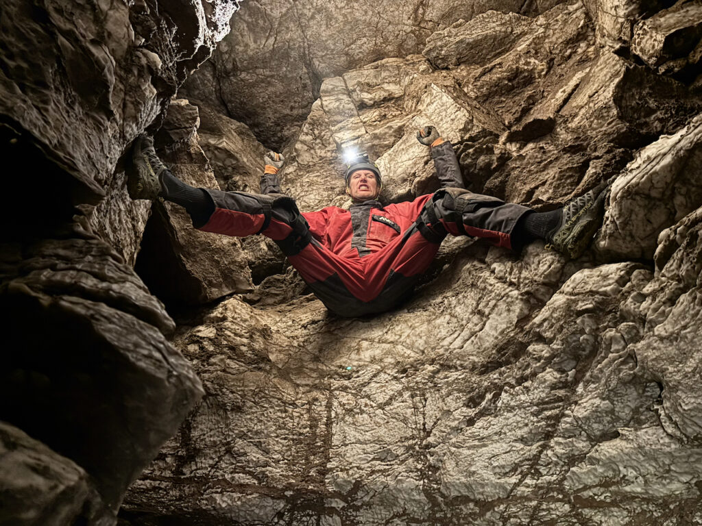
We decided that Sarah would continue using the tablet, while Alex set stations. After finding B6, he ventured on into the passage to find a good next station. Unfortunately, the passage in question is rather tight, and narrows progressively along its length. Just as we were getting started, we realised that we needed to do a backsight check, which was extremely awkward given the dimensions of the passage.
Following that we continued on, and soon reached a very committing constriction. Alex was unsure if he’d fit, but gave it a go. It required removing his helmet, but happily he popped out into the (relatively) spacious A-survey.
Our next challenge was finding stations in this part of A-survey; the nearest one (A23) was either washed off or covered by mud, so we gave up and tied in to A22.
With that, we were out of time, and had to start making our way out. Unfortunately, we had left our bags back at B4, so we needed to collect those first. Alex had the bright idea that it would be easier to get to them through A-survey rather than doing the squeeze again. He quickly regretted that decision after a few minutes crawling over sharp limestone cobbles.
After finally reaching our bags, we packed up and made our way out of the cave. We were joined by Erin & Eoghan shortly, and headed back to the vehicles. Good trip!